
I will not bore you with the logistics of getting back to Saltfleet, so let’s just say the whole process was trying and expensive but here we are, dropped off in front of the horrible pub we ended up in some days ago.
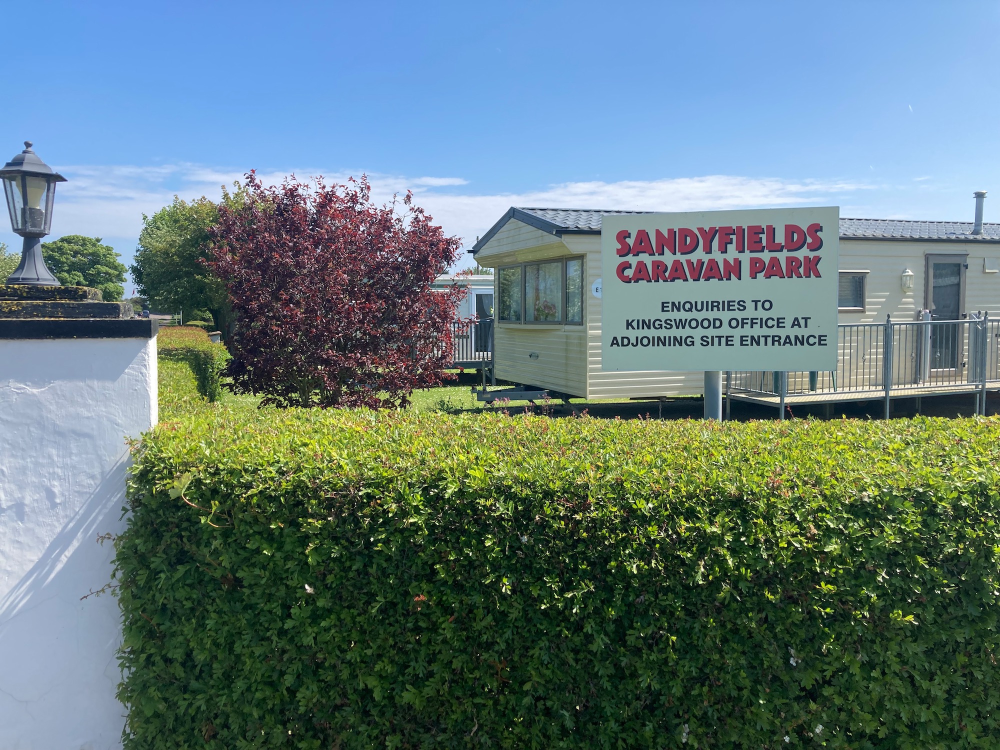
We start in front of the small war memorial, which has seen better days, and walk up past a caravan site heading for the marshes.

It is here where we experience a minor panic when I discover that my OS map is not working and assume that is because I have run out of data. Fixing this involves a phone call, but I then discover that I have no signal. Trying to keep calm I walk around waving the phone above my head and a couple of minutes later, manage to put the call through and successfully make it through the electronic gates of options, passwords and codes. On the other end of the line is a young girl who assures me I haven’t run out of data and suggests trying a few things which involve me fiddling about with the settings – they don’t work. Trying to keep on an even keel as the signal waxes and wanes, we finally settle on that tried and tested technique called switching the phone off and back on again. I tell her I had already tried that but was willing to try again. This time it worked – the relief!
I suppose you might be thinking what’s the problem, you’re following the coast – just keep the sea on your right (or left depending on which way you’re walking) but there are many occasions when we are presented with a choice of paths, or a way around an obstacle, where the map is invaluable, not least to tell us exactly where we are.
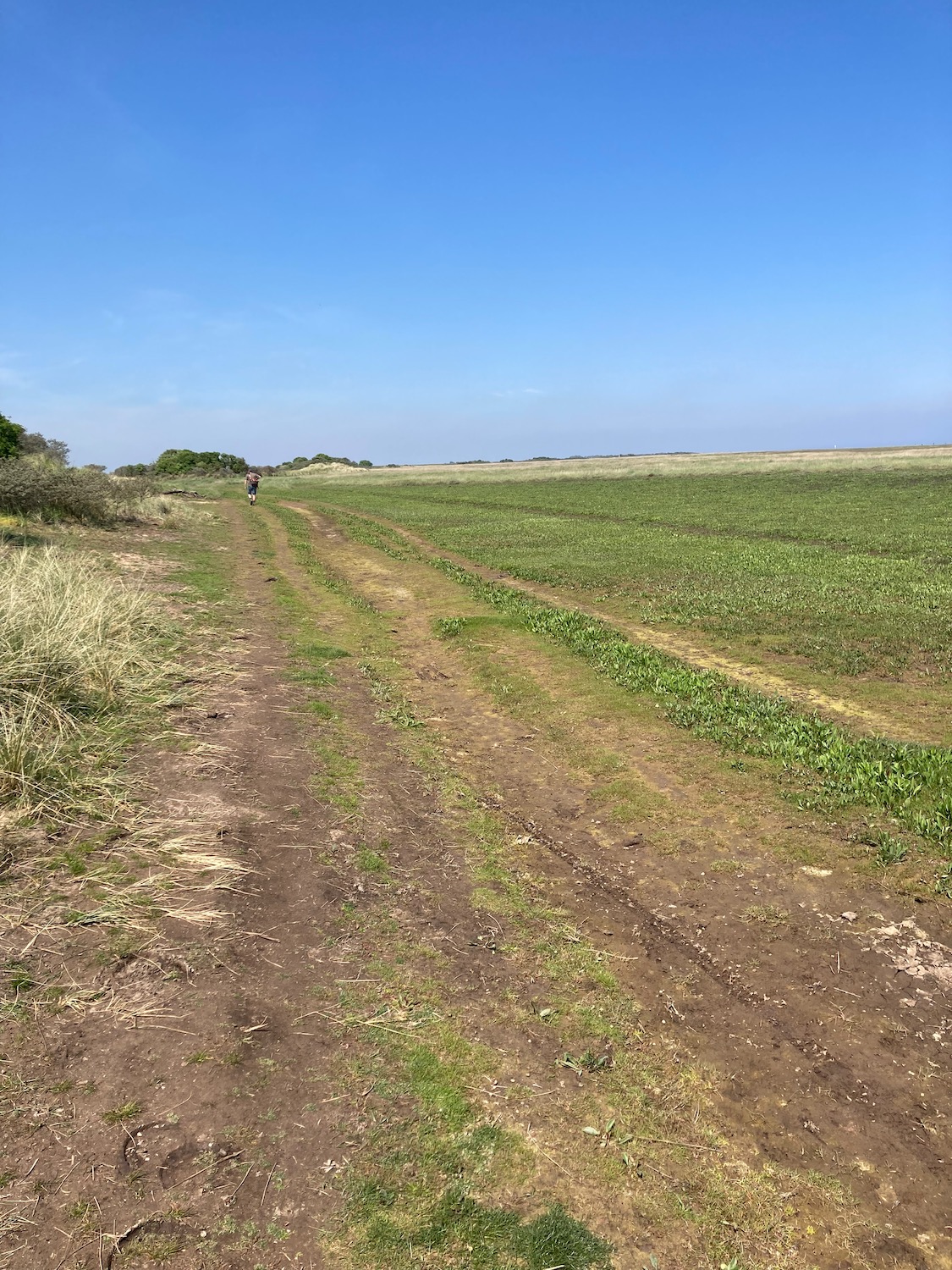
Crisis averted we start walking along the permissive path which separates fields on our left and an area of marshland on our right called Howdens Pullover – did he ever find it I wonder?
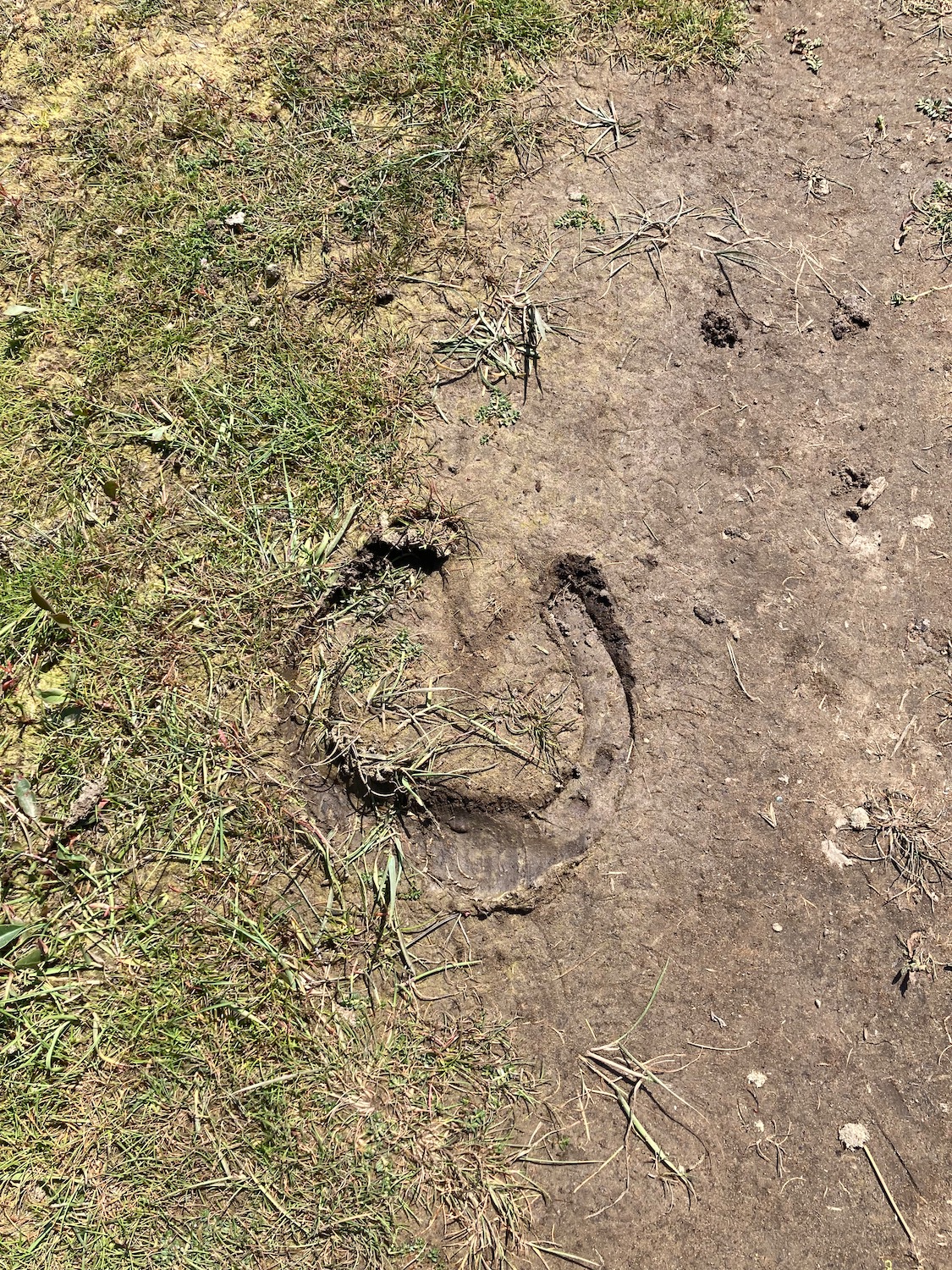
We are not the only ones to walk along here – what a huge hoof print.
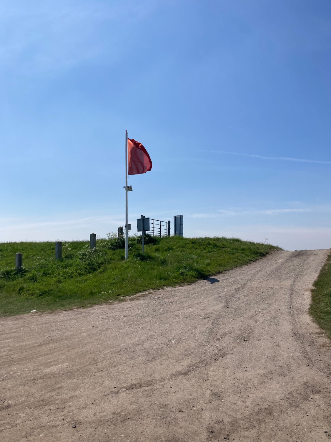
After a mile or so a track leads off to the left and a red flag is flying – we are not going that way so it probably doesn’t apply to us, does it?
An information board tells us where we are – “a special place where wildlife lives in harmony with the military planes”. Strangely enough it doesn’t mention seals – I do know that Donna Nook has a resident seal colony – they return each year in the autumn to give birth. What a strange place to choose to have their young, under the roar of military aircraft dropping bombs.

At one point the path moves inland a little to avoid a stretch of water and lead us away from what is marked on the map as a Danger Area in big red capital letters. Shortly after we come to our first hurdle – our way is blocked and in no uncertain terms. There is a road leading inland but that doesn’t look too inviting, and another track off to the right which leads up to a control tower where a red flag is flying. What to do?


We say hello to a friendly horse in a nearby field while we think about it……………………..

In the end we go for the track off to the right – after all it does lead back to the shoreline……….
As we round the front of the tower we notice a man watching us through the front window, so Damian attracts his attention and asks for directions. He turns out to be the air traffic controller for the Donna Nook bombing range and is very friendly, answering all the questions we ask about what the training range is used for (to train UK and USAF pilots in bombing and the use of guns). I then ask about the red flag and he fudges an answer and says we needn’t worry about that – then why fly it? I think……………..he does however say it is important to stay on the landward side of the warning signs that line the path.

These appear at regular intervals as we walk along a muddy path on the edge of the enormous bombing range – I can just about make out bombing targets for the planes but they are too far away…………………………..

A little later we move into the dunes at Donna Nook where the seals apparently like to come back to every Autumn. The path then moves up on to dry land at a place called Stonebridge, where there is a large car park – presumably to cater for the hundreds of visitors coming to see the seal pups. From here it is a pretty straightforward run along a marked footpath which runs inland, encircling an area of wetlands called Porter’s Sluice.

……………….and a three mile straight run back to the car at Horseshoe Point.

Distance: 9 miles

Sounds like an eventful walk!
Indeed – I’ve come across the ambiguity of the red flag before so next time I’m going to ignore them unless I can hear shooting ….
I followed the same route but then found myself in the middle of 2,000 seals with pups, so tried to avoid them and push through a blackthorn forest which was the worst hour of my life. I was picking thorns out for the next 24 hours!
2000 seals?! – I thought I was lucky when we walked past 50 or so on a Norfolk beach some years ago. Did you notice their strong smell or were you preoccupied with fighting your way through the buckthorn? That sounded VERY painful. 😣
oh / it was blackthorn not buckthorn – need to get it right 😳
Haha. You were right. It was buckthorn.
Yes strange that the seals choose to give birth there! Glad you got your phone working eventually!xx
It’s great being Tricia’s walking companion, I get to triumph in her achievements…..but mock her roundly when anything goes wrong. I get to laugh at her worries, like too many cows in a field, and celebrate with her when we get through a tricky patch of navigation with her unerring eye for which way to go…… but in ALL the walks we’ve done together the GPS mapping has never broken down, ever. As Tricia mentioned, it’s been particularally difficult to get to the beginning of this walk , mostly because it is literally in the middle of nowhere, and as this isolation is sinking in, and I see the taxi trundling off into the far distance, a speck on the horizon, the news is breaking that the phone mapping is dead……like Lyra struggling to read her aleithiometer, we suddenly don’t know where to go……..My mate Robert Hasson who mocks all modern technology would be laughing loudly at us now. He doesn’t even have a mobile phone. Any way, as Tricia has taught me over the years, things are seldom as bad as they seem and sure enough after what seems like an eternity of chatting to a random stranger in a far away call centre, the GPS is working again, and we’re off.
Today’s walk is pretty much going to be dominated by the military. One reason why many walks take us inland far away from the coast is because the military have commandeered huge sections of coast for war gaming and Tony Stark type new munitions testing. Miles and miles of our coastline are simply off limits to ordinary citizens. This section of coast is a kind of compromise. We can walk along the beach as long as we stay to a demarcated path between the green scrub of the dunes and the beach itself. There’s loads of barbed wire, red flags and watch towers. The instruction boards are wilfully complicated and I think are designed to put off mad walkers. In fact we’re not really sure if we’re allowed to proceed….so we walk into the lions den and approach a watchtower. It’s a uniformed soldier on his own up there but he seems glad of the opportunity to talk to another human being. He tells us we are allowed to walk but just seems mystified that we might want to? We do our best to be polite and not use any dodgy Russian accents in the chat. And off we head, fearful of the enormous puddles of mud he’s promised us. Turns out to be dry as a bone…..
This beach is a spectacular site, simply enormous. Not only left to right but far, far out to the sea which is like a faint line of brightness on the horizon. To steal a line from Robert Macfarlane’s description of his walk on the Broomway across Maplin sands, ‘When the tide goes out , it goes out a great distance, revealing shires of sand, packed hard enough to support the weight of a walker….’
Well we don’t go that far out as the sign boards say we’ll be immolated by unexplored Tony Stark style military debris if we do. Plus we suspect the soldier in the watch tower has his binocs out watching for infringements .
A mile or so along the beach track we see a fire engine red Land Rover trundling steadily out of the watery distance heading straight for us, or so we think, as we round a bend we see it change direction and head for a low cluster of military buildings and another watch tower. Emboldened by our success so far we wander up to chat to the people in the red Landrover who are by now unloading stuff out of the back. They’re friendly and approachable and don’t seem too puzzled by our presence. They tell us they’re not soldiers, they’re civilians working for an American company, whose job is to manufacture targets for the the Airforce, they then drag them down to the beach a mile out towards the sea and the jet fighters swoop down to straffe or bomb them! Then they go back down to photograph the results, which are then uploaded to the flight tower and finally conveyed to the pilots. It’s the ultimate shoot-em-up computer game. Luckily for us they tell us there’s been no live firing today.
It’s a strange world we live in?
It’s been an exciting walk so far…..