We are back at Fraisthorpe Sands turning right this time………Damian waits for me to tie my bootlaces.

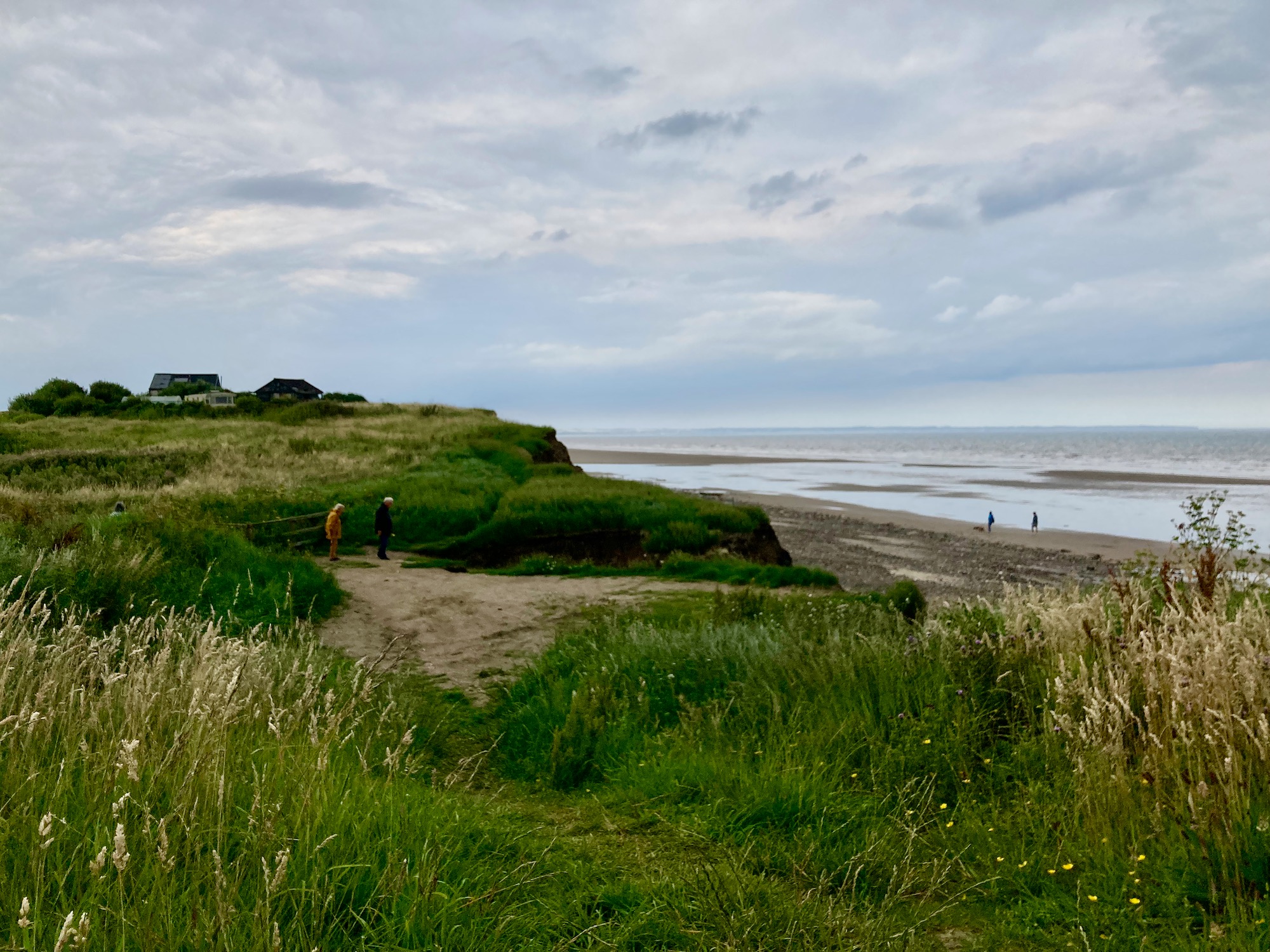
Despite the overcast sky there are quite a few families braving the weather – maybe they know something I don’t…

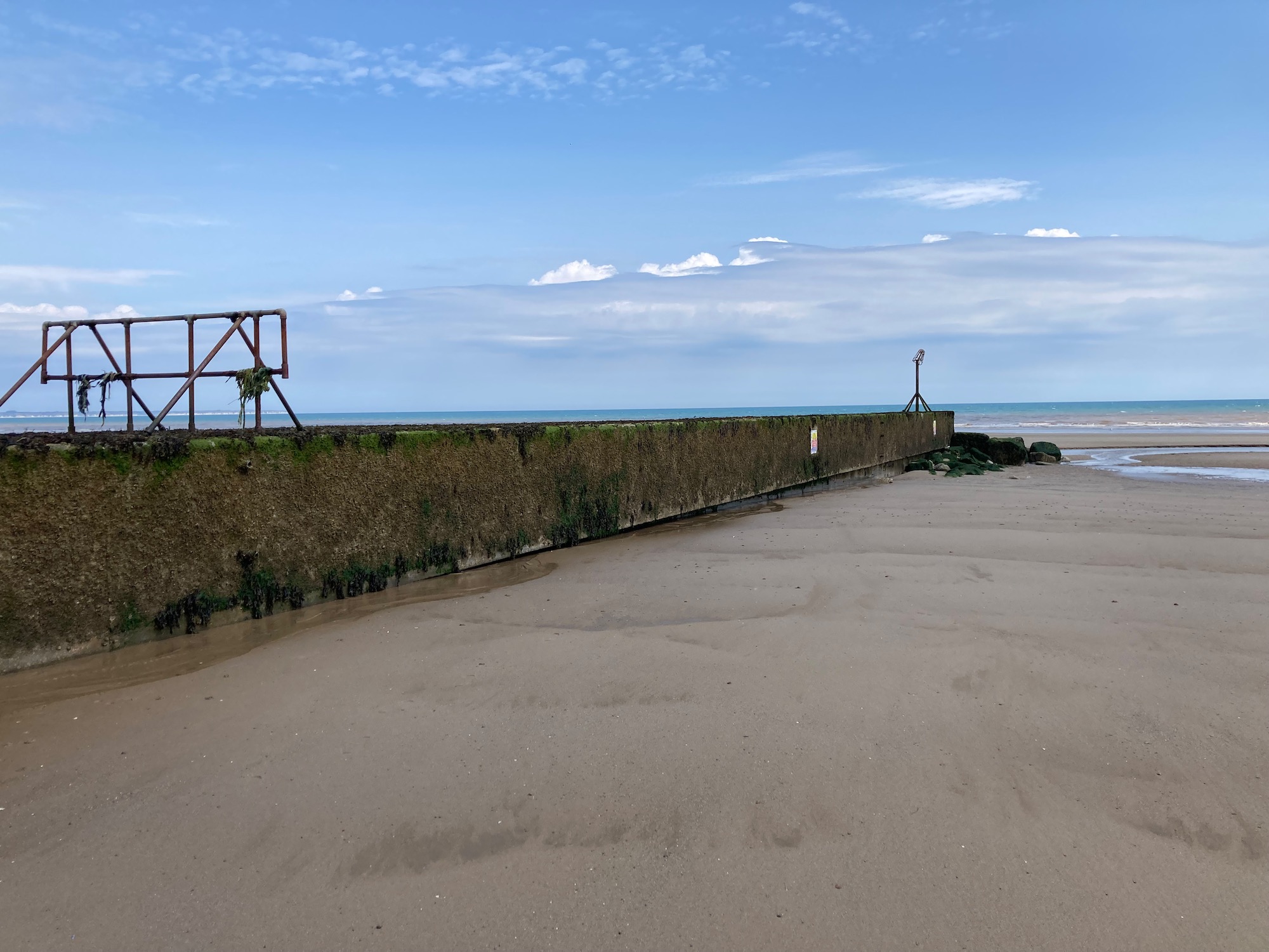
The usual mouldering relics of second world war defences………..

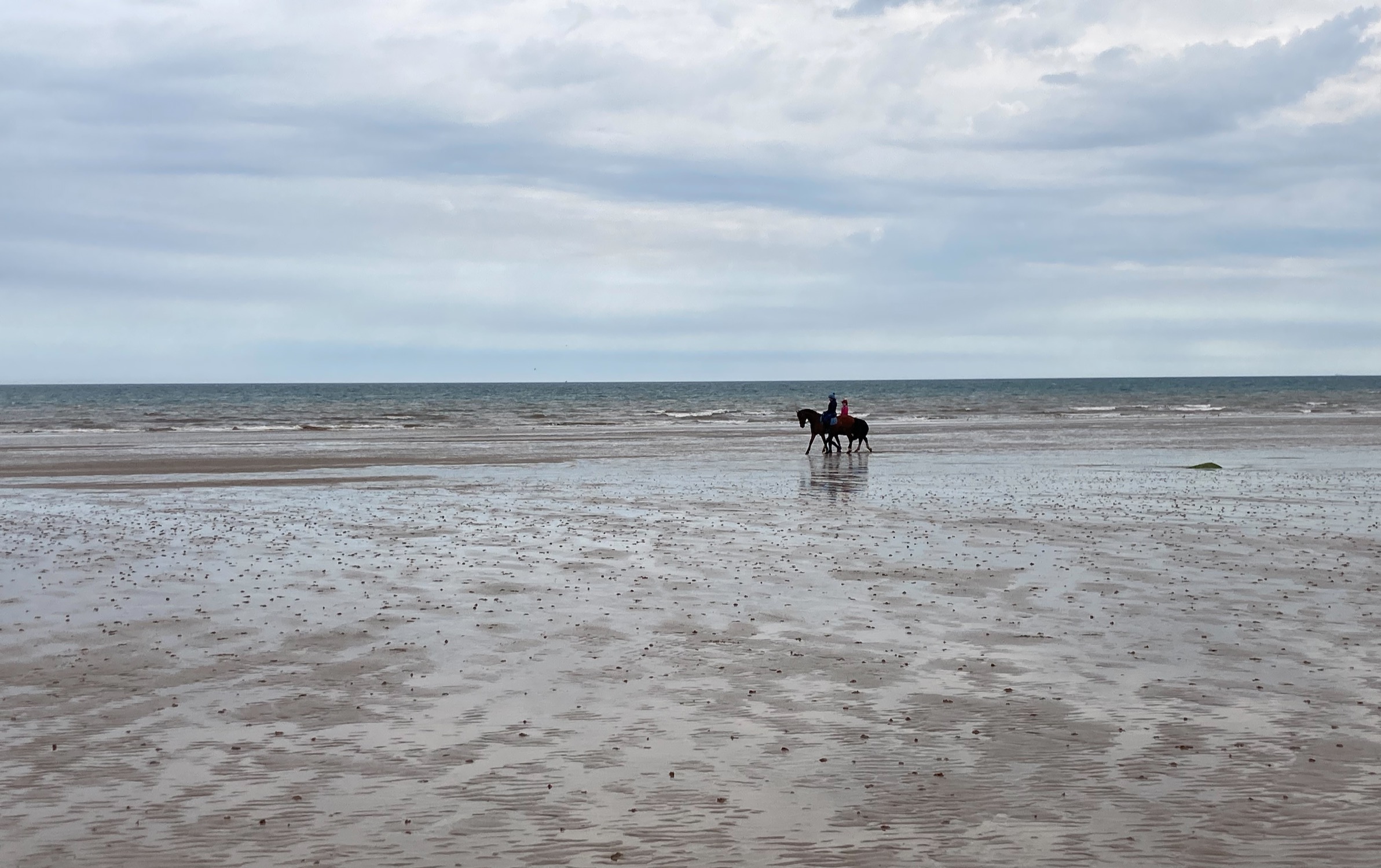
And in the distance a couple of pony riders. As I grew up in mid Wales there was not much chance of galloping along the beach – we had hills – but I have done it here in Denmark and there is nothing better.
The beach empties of people and we are alone……………………
After about two miles we are faced with the Barmston Main Drain which crosses the beach from the cliffs to the sea. As it is low tide we can easily get around the drain but it is at this point that I feel we should move up onto the cliffs as we are not sure of any access points ahead and I don’t want to get stranded.
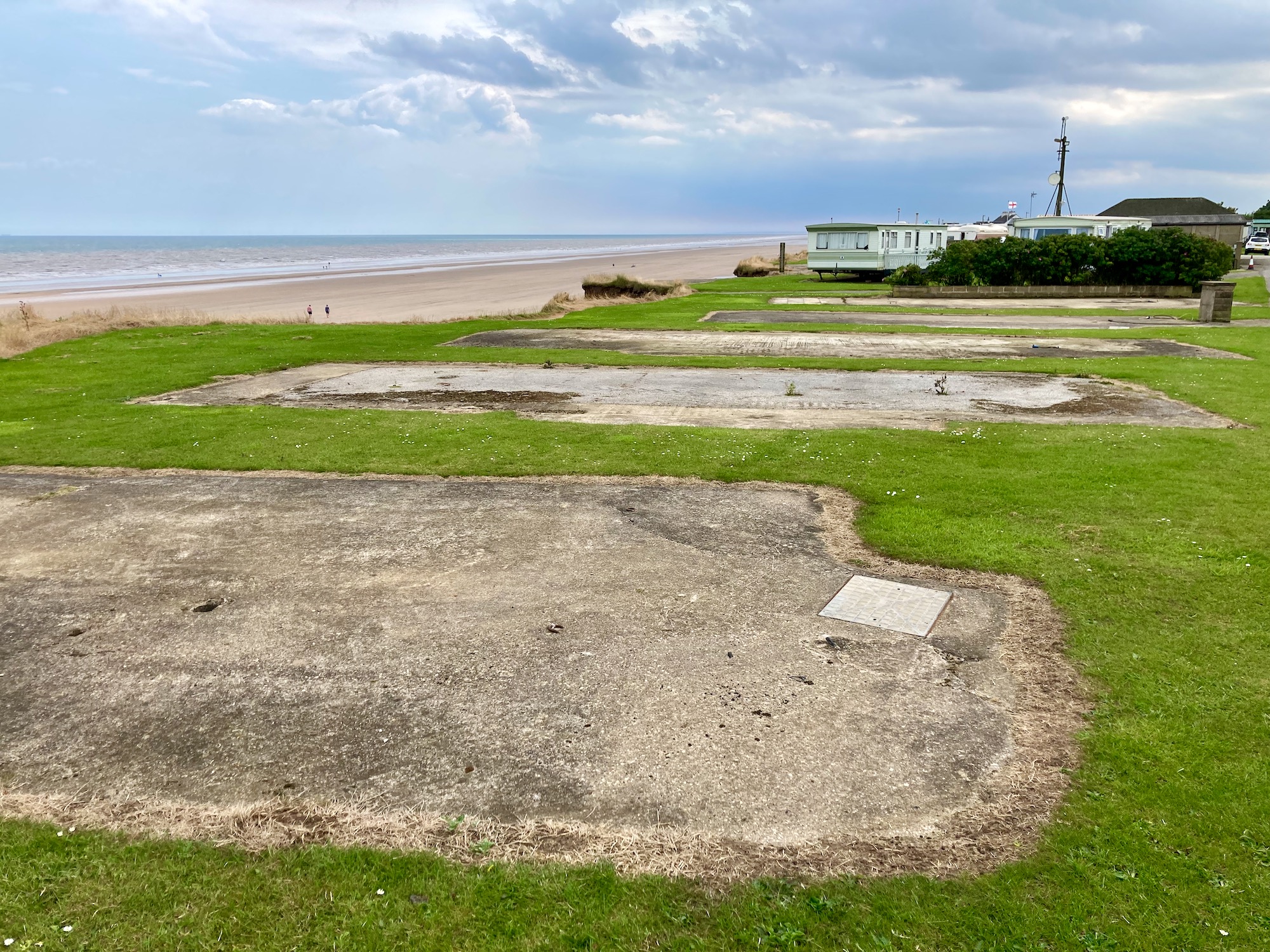
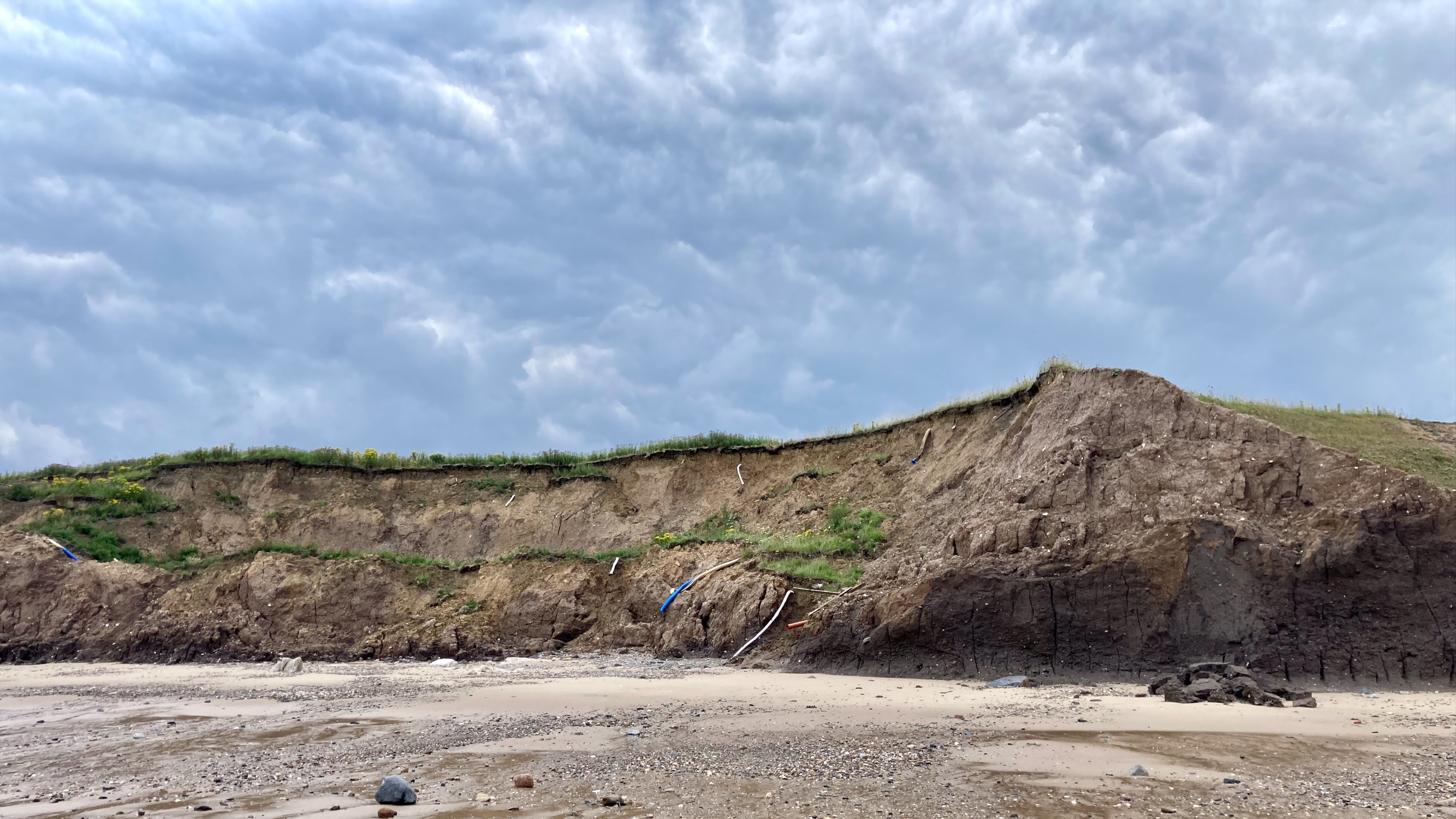
We clamber up from the beach to join a permissive path which runs along the cliff edge. This leads us to a small caravan park called the Criftins where the effects of coastal erosion are very clear. The concrete pads where caravans once stood are now empty, their drainage pipes hang limply from the sticky clay of the disintegrating cliffs.

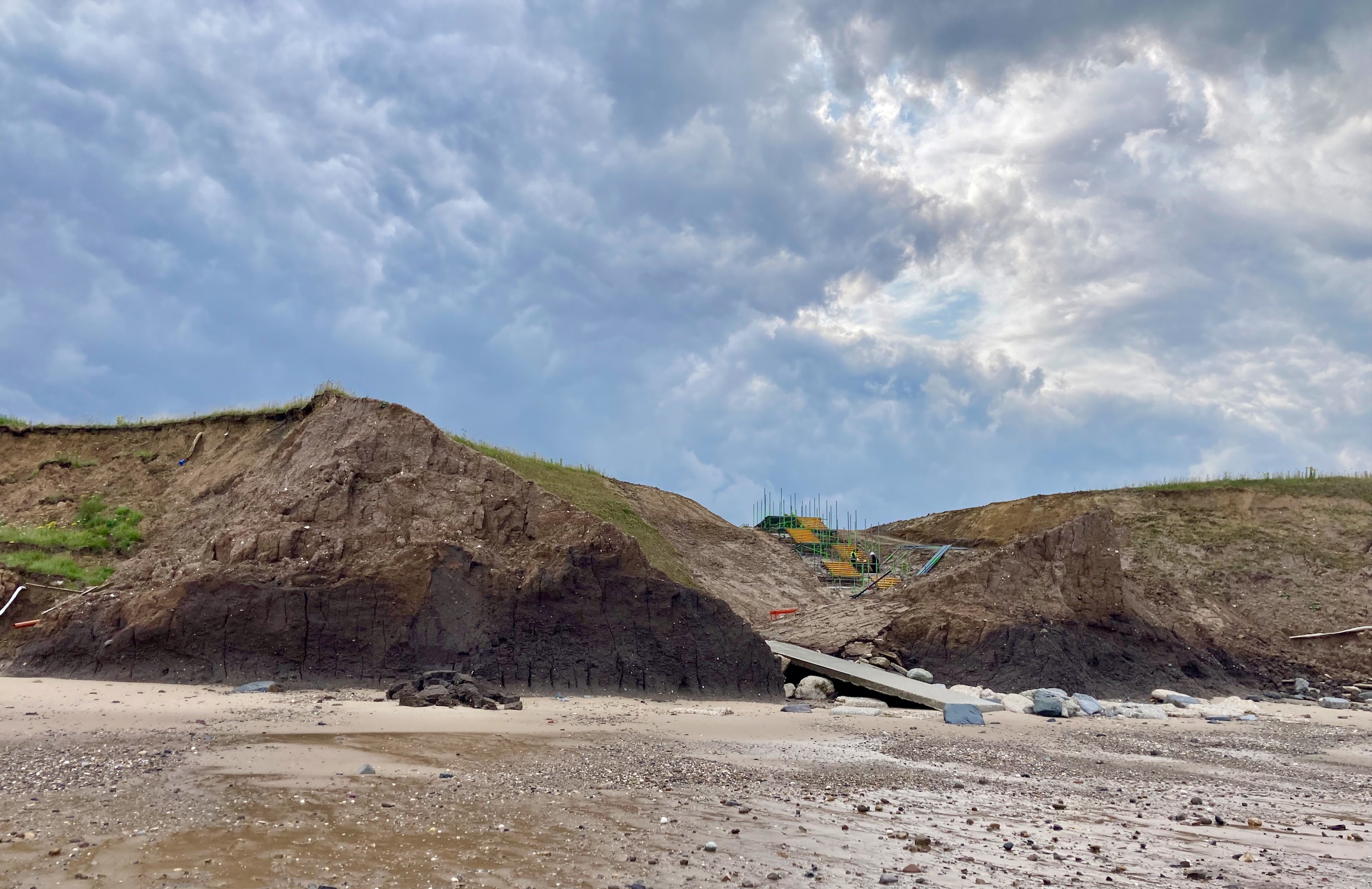
A little later we pick our way carefully across the remains of a road…….

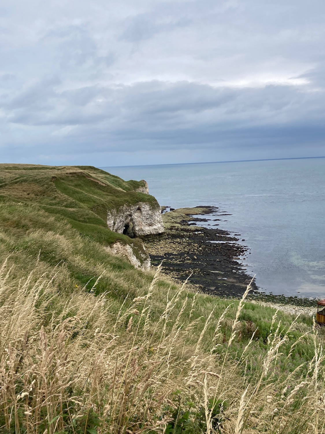
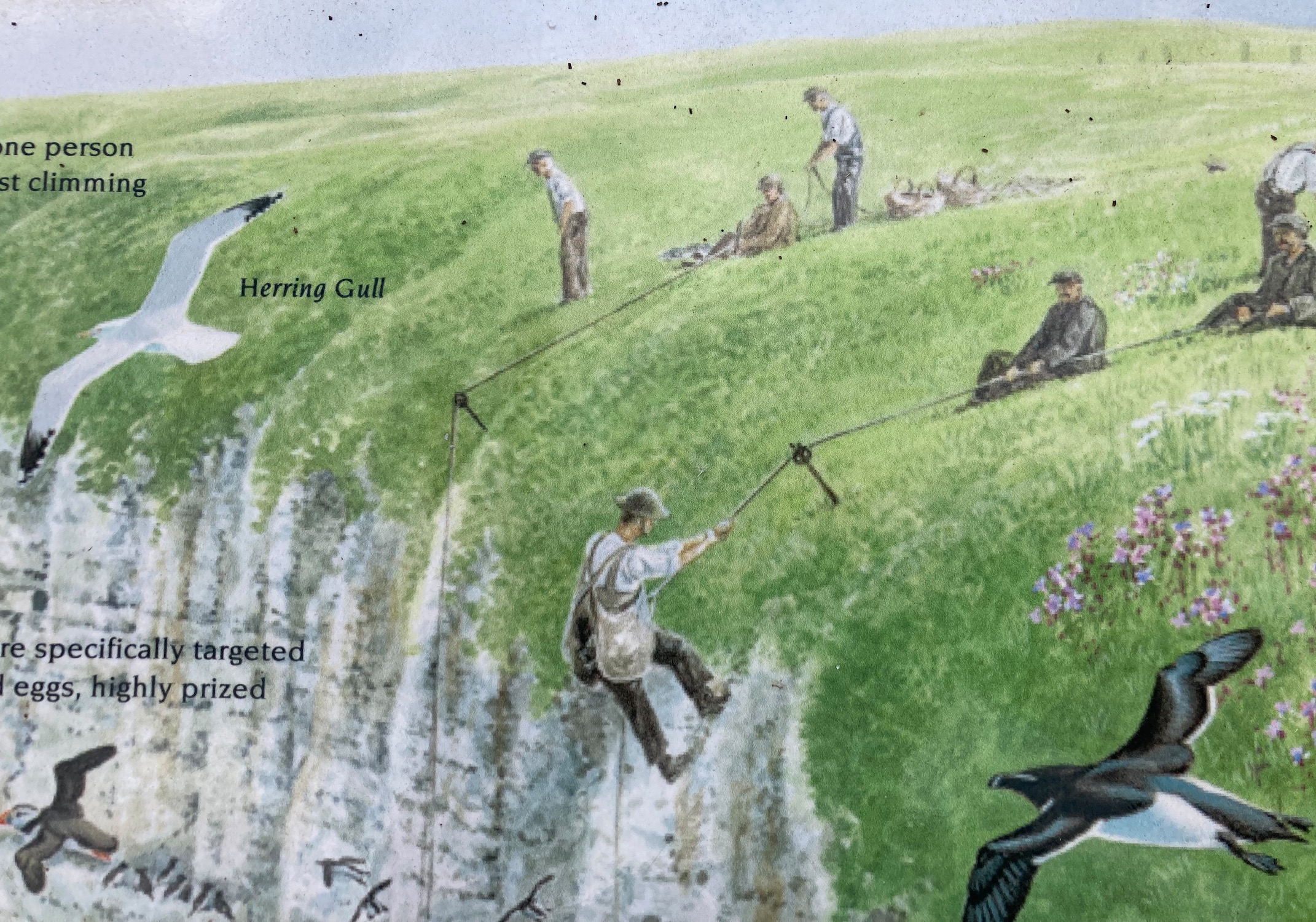
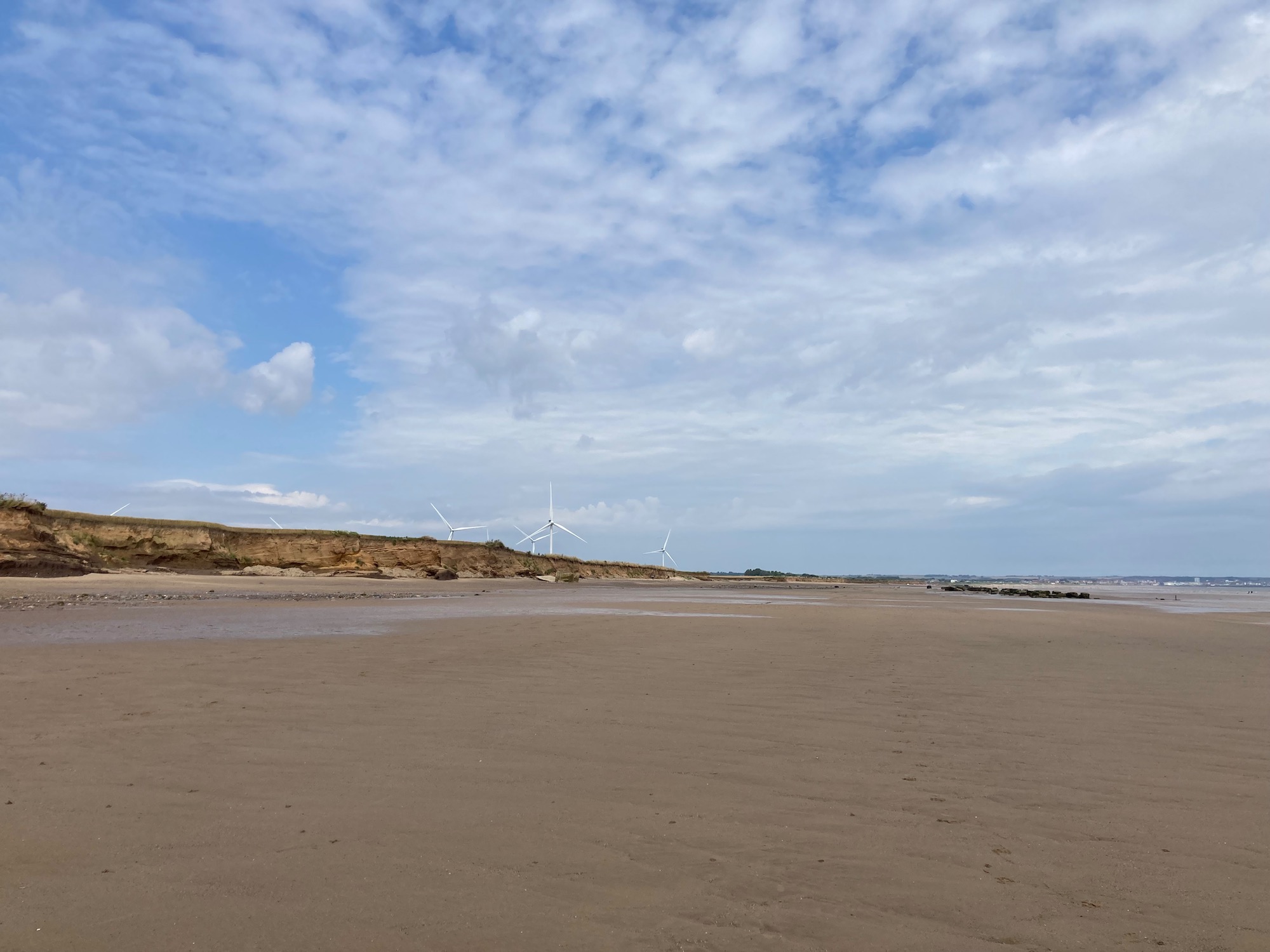
In the past few weeks we have been walking on the Holderness Coast, which is the fastest eroding coastline in Europe – it erodes at a rate of 4.5 meters a year. Roads, houses and caravans have been lost to the waves, as have safe footpaths down to the beach.
However, as walking along the beach will be so much quicker and more pleasant than following unreliable footpaths or roads, we now decide to go back to the beach down a boat launch road from the edge of the caravan site.
And from here on we are on the sand – we pass Cobble Gap and Skipsea, although we don’t see anything much apart from the roofs of caravans close to the cliff edge.
At one point we reach Withow Gap, where the cliffs are relatively low, so we scramble up and find a spot for lunch. It is a relief to be lying on warm grass and flowers after the slightly gloomy atmosphere of the debris on the beach and the crumbling cliffs.
After lunch it’s back to the beach and it’s only after a couple of miles that I start worrying again about getting off it. It should be possible to walk all the way to Hornsea before high tide but you never know………………
So…….as we walk past Skirlington caravan site I am relieved to see that there is a clear rocky path winding up from the beach to the top of the cliffs, so if we can’t climb up at Atwick, which is the next village, we can always come back.
On we go…………… drainage pipes dangling hopelessly from the cliffs to our right.
At one point it looks like some attempt is being made to create an access path, but I’m sure it will be no match for the next unexpected storm surge in the North Sea.
We meet a couple handing hands, skipping merrily towards us – they are not locals and have no idea whether there is safe passage at Atwick. We decide to turn round (or rather I do, Damian is a little braver than me).
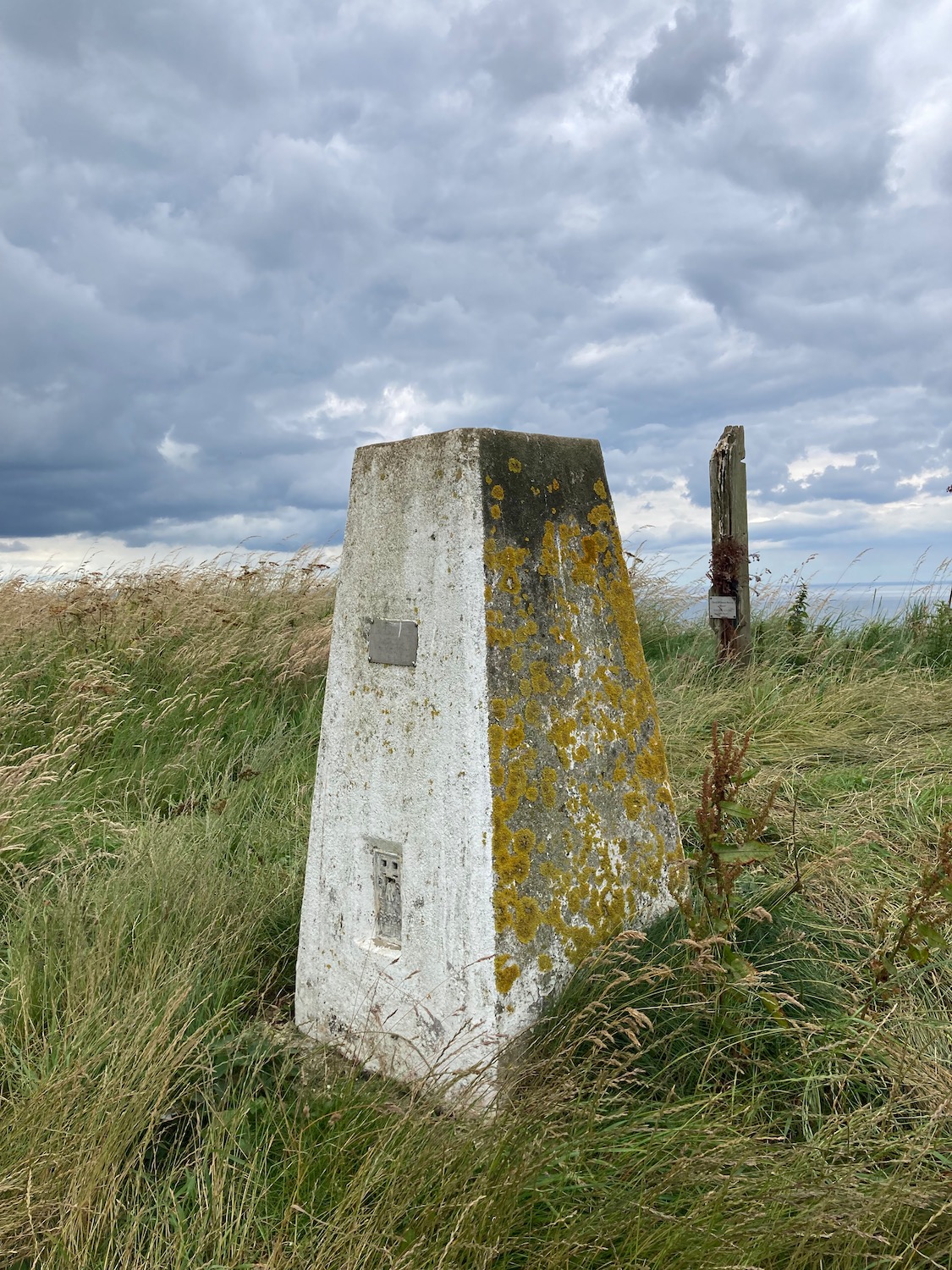
Back we go to the rocky cliff path at Skirlington, which takes us up to the caravan site where we wiggle our way through onto a marked footpath called Long Lane. And that is what it is – a long straight trail through fields. running parallel to the coast. We pass a wonky trig point – research tells me it has been moved back from the cliff edge to save it.

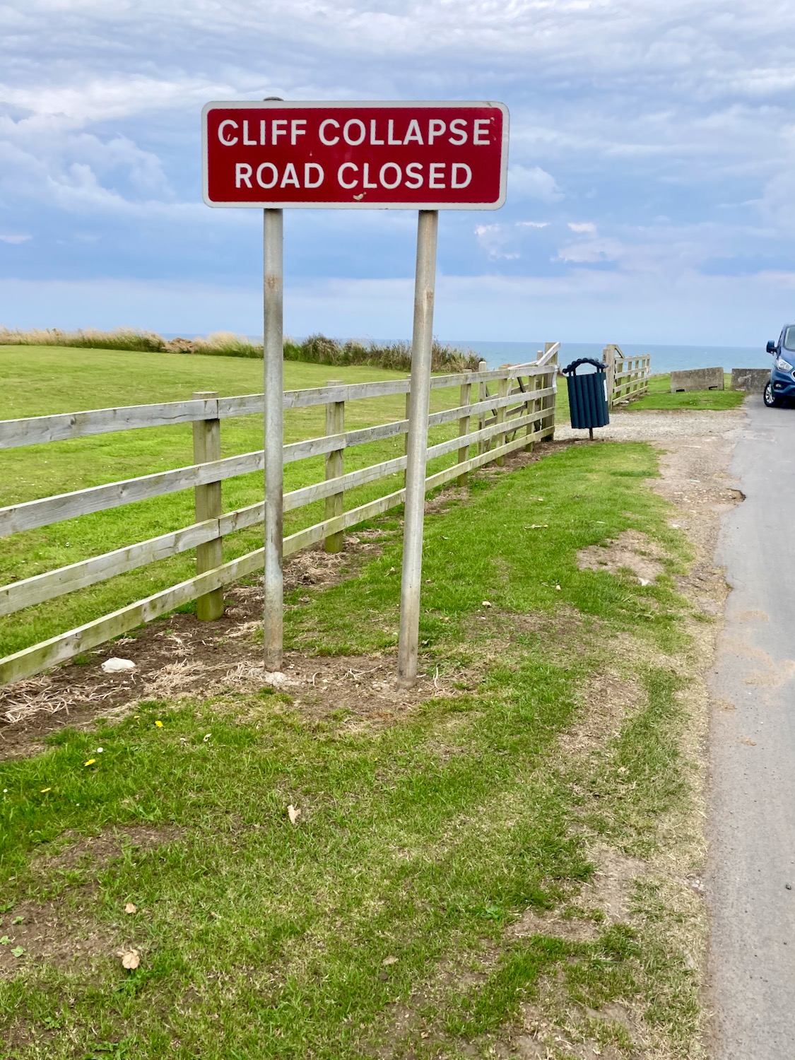
Long Lane comes to an end at a minor road – I look left and see the familiar warning sign.
We turn right and into yet another caravan site – two men are having a lively conversation so we wait until they’re finished and then ask for directions. The map does not show a clear path into Hornsea but local knowledge can be invaluable. To our delight the site owner says yes, there is a clear path all the way – we just need to walk through a couple of fields first. We start walking through the site…

It even has its own pill box….

When we come to the first field it is not clear what to do – there is a line of downtrodden grain through the field but it doesn’t look too promising. A couple of minutes later I hear a shout – Damian has found a clear path on the edge of the field so off we go.
A little later we come to what’s marked as an official footpath which circumvents a boatyard and carries on into the outskirts of Hornsea.
We are both very tired now and it’s difficult not to succumb to the invitation to rest, but we still have a mile or so to go until we reach the town centre.

Twenty minutes later we reach the Post Office – I take a picture of this quintessentially British phenomenon before we head off to the pub.

Distance: 12 miles