
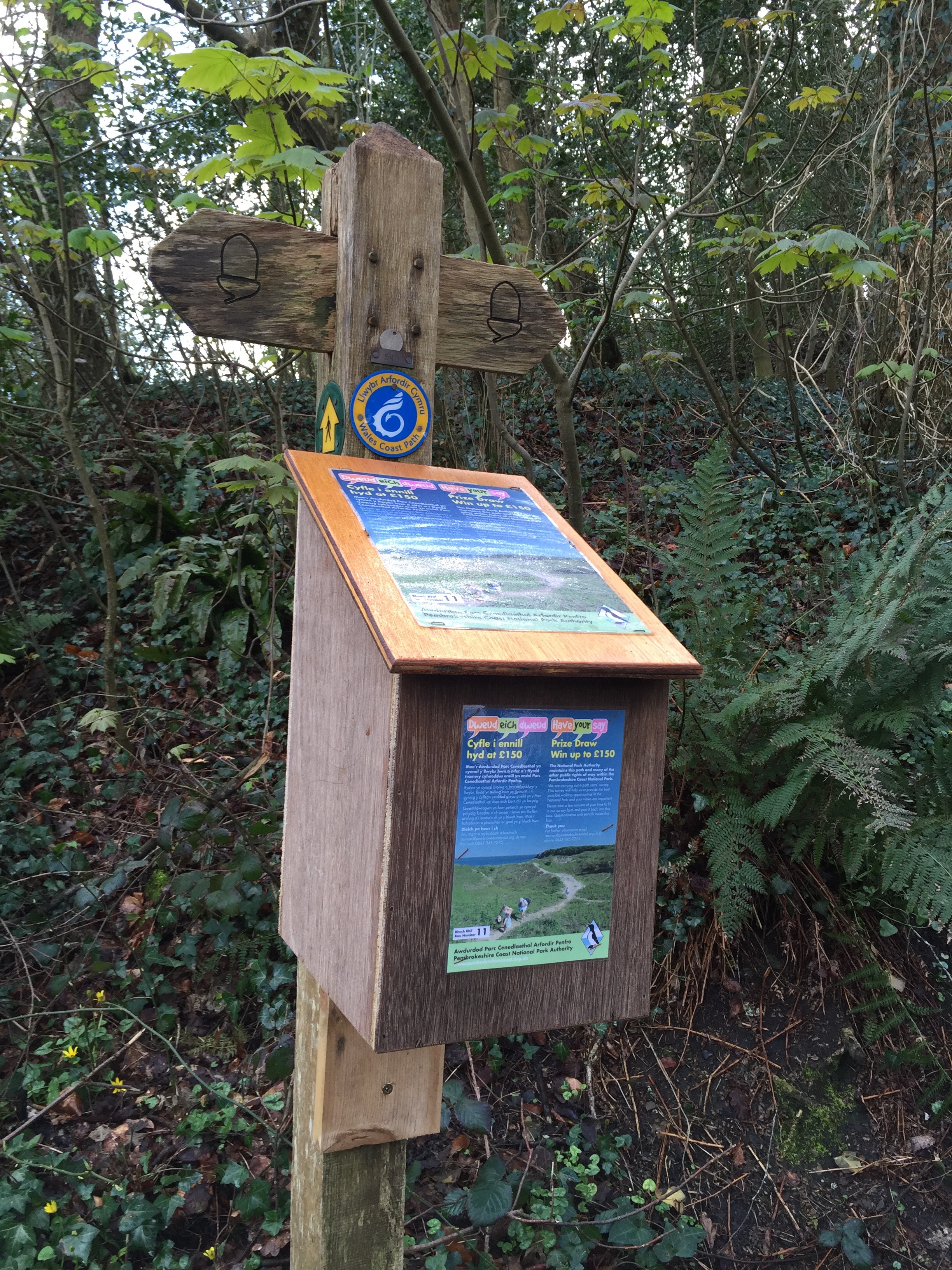
Back again in Saundersfoot and what a difference a day makes – blue skies and sunshine, follow me down a narrow tarmac road to a sign pointing up to a beautiful stretch of woodland that I would have photographed except that my iPhone keeps telling that I don’t have enough storage to do so. I don’t really understand the message as I spent an hour yesterday deleting photos……..oh well.
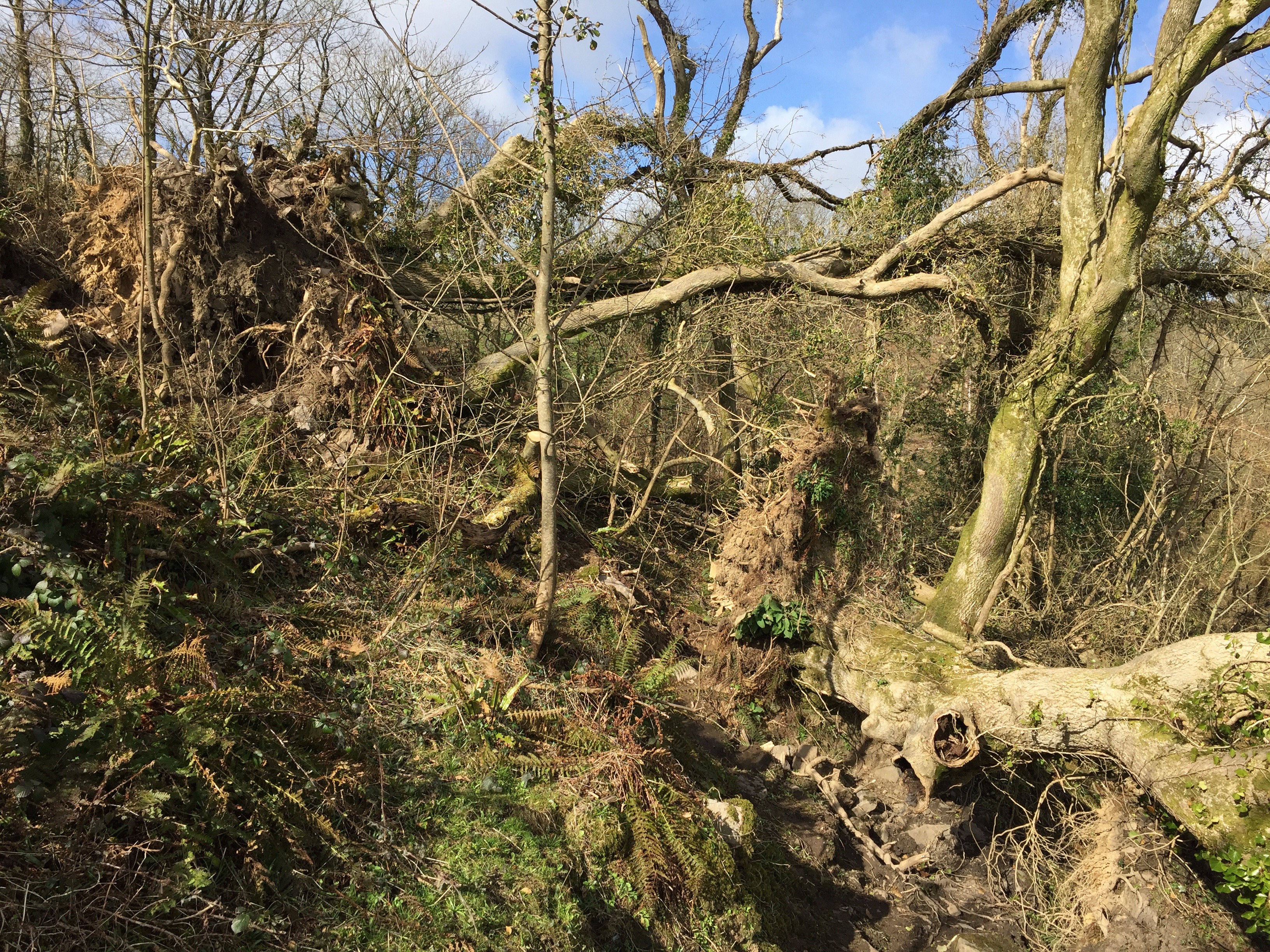
Coming out of the wood the path follows the coast, there are some steep climbs and descents and I start to wonder if I dare use my walking pole. The reason I am a little cautious is because I have a hunch that the continuous jarring of my right shoulder when using the pole, may have been what brought on the ice age (the 9 months of adhesive capsulitis or frozen shoulder to friends). Anyway, I now find myself in another patch of woodland where I walk past signs with warnings of felling. It is very quiet so maybe the foresters are on holiday – heavy trees lie uprooted around me, their roots tangled and dry.
Out of the wood I’m back on the cliff in the sunshine and as I climb up and out of a place called Waterwynch, I start to see glimpses of Tenby in the distance. This is where I will be staying the night so the plan is to empty my rucksack and continue on to Manorbier. The best laid plans…………… a look on the map reveals that my BnB is in fact some distance past Tenby in a village called Penally…………oh well.
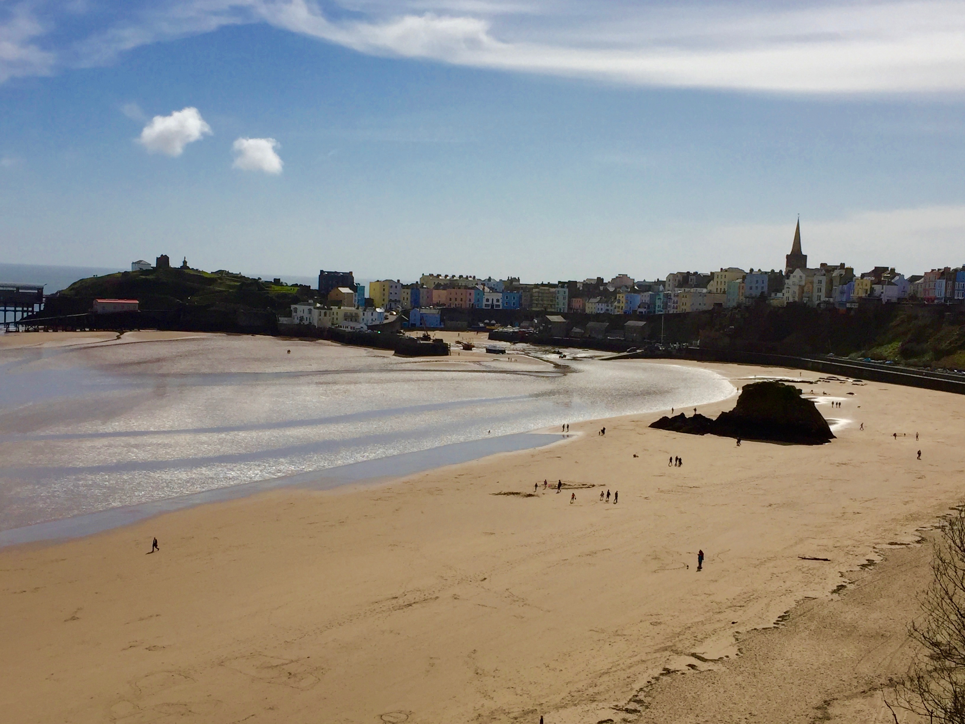
As I walk down into Tenby I take a few photos of the pretty little town but then my iPhone gives up again. Here is one of mine with the tide out……………..
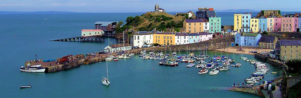
…….and here is one from the net with the tide in – this one may disappear after a while, something to do with copyright so enjoy it while you can. The long low white building with the red roof is the old lifeboat station which is now a home and was the subject of an episode of Grand Designs.
Tenby has two beaches, a north and a south – before heading off east from the south beach I stop for a cup of coffee in an Italian restaurant which is doing brisk business and where they all seem to be Italian!
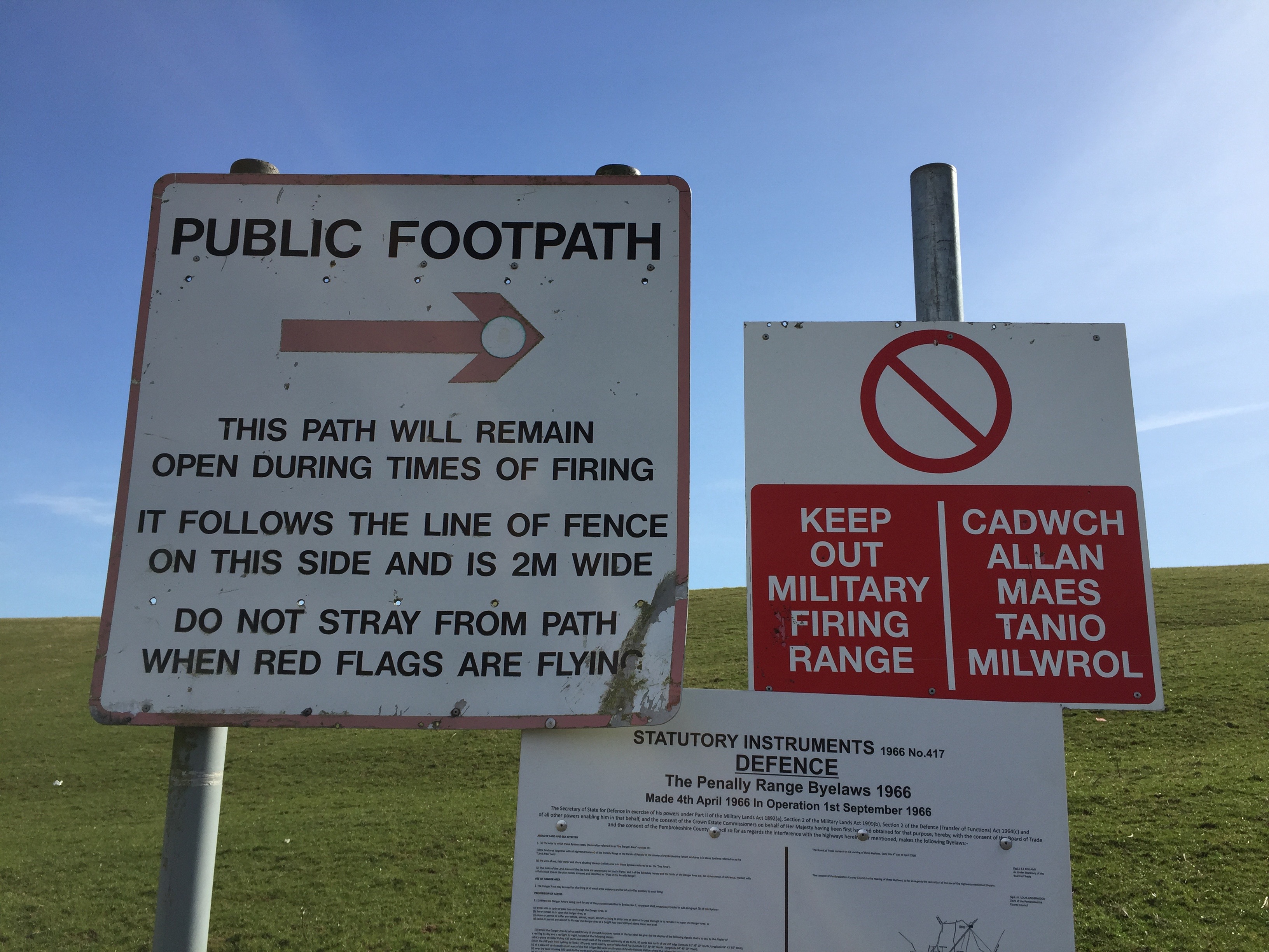
Refuelled I stride off down the long wide beach called The Burrows keeping an eye out for the turn off through the dunes that will take me to my accommodation. The path leads to Penally Station and where I’m heading is just up the road. I quickly empty my rucksack of all but the essentials and head up a tarmac road where the map shows a turning off to the left to take me back to the coast. I walk through a few gates and come out on the boundary of a military shooting range – it is Good Friday so no red flags flying.
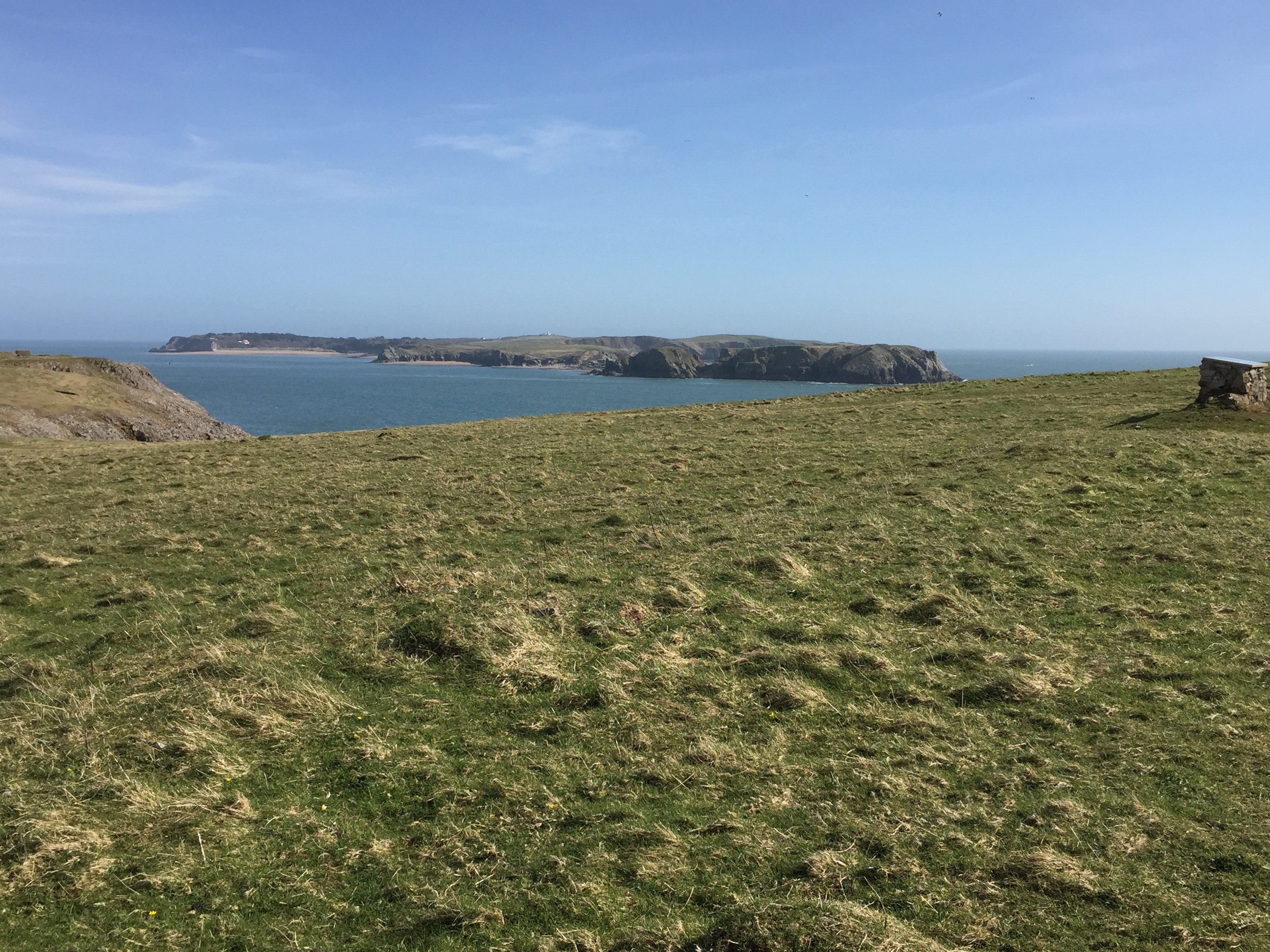
I head for the horizon and come out onto a wide grassy path that runs along the top of the cliffs – from here I can see the outline of Caldey Island.
I will never forget the description in Robert Macfarlane’s book “The Old Ways” where he asks us to imagine the first few monks of the 6th century setting off in a coracle in the cold light of dawn, bent on finding a new home……….the Cistercians are still there.
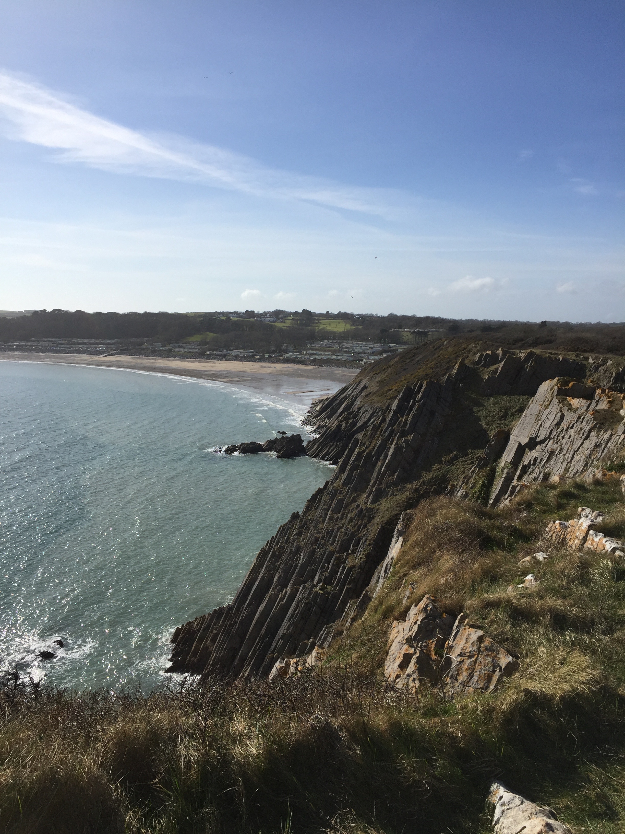
On I walk in the late afternoon sunshine, I am making good progress with my nearly empty rucksack bobbing about on my back. Soon I start to see the serried ranks of caravans at Lydstep Haven in the distance. I am tempted to stop for refreshment in the site cafe but decide to eat a banana on the hoof as I don’t want to arrive in Manorbier too late for the bus back to Penally.
Back up onto the cliffs I skirt another military enclosure and promptly get lost! I spend a long time walking back, forth and around two large fields of unusually curious sheep trying to find the path. The shooting range makes it difficult to just head for the sea and my only point of reference is a farm and its narrow dirt road, which I eventually decide to take all the way into Manorbier, an attractive little seaside village with its own castle. I head for the pub which turns out to be just across the road from the bus stop, and spend the next 30 minutes deleting photos over a pint of real ale. Must remember to take my camera next time.
Distance: 12 miles

The Cistercians have a little web site describing the days regime on Caldey Island……You wouldn’t want to go there especially in a Coracle. Do you remember the chapter in ‘the old ways’ describing the walk out on the Broomway…..now that sounds truly terrifying…..
Will Self and Robert Macfarlane: Walking wild … – Big Issue.
This is definitely worth a read…….
Great read as usual. Read the last three together. Perhaps shouldn’t have laughed at you tearing your strides and carrying on (just like the poster says).
What you need is a good old sunny clime where the dots are further apart and you can wear a coracle as a hat!
Well – off to sunny climes tomorrow,a month in Australia unless we need to cut it short (Damian’s Mum is failing). Love Tricia x
Great to see you walking again, and what a wonderful section of coast! Hope you enjoy your Australian trip.