Who would have thought that the highlight of this walk would be the promenade at Redcar. We park the car at Zetland Park which is roughly where we finished last time and start walking along the seafront. Revamped in 2013 at a cost of £30 million pounds the promenade is full of surprises.
We start the walk from this Bansky looky likey piece of art – not quite sure what it means…a vision of life on earth when we have polluted ourselves out of existence? Life on a distant planet?
We phone an Uber to take us to Staithes as there is no direct bus. The driver is from Irak and we get to hear a little of his story. Fleeing from the chaos in his country with his family, he managed a string of temporary jobs and eventually embarked on a four year Computer Science course at Hull University. After finishing a Masters, he now hopes to start a PhD. His wife has just recently completed her medical training and is now a qualified GP. Their two children are also planning to study Digital Learning and AI next year. It warms the cockles to meet such a resourceful family, taking refuge in the UK and working so hard to contribute to our society. Strangely enough his English is not great……………but then I am an English teacher and maybe a bit critical..
Reunited with our walking boots, that our lovely Bnb lady had kept safe for us, we drive off to Saltburn (nothing to do with the film) to settle in to our holiday flat overlooking the bay. The sky threatens rain and at this time of the year the days are very short, but we still decide to cover some ground by walking four miles or so to Redcar.
It is again the Patrington Pumping Station that calls the shots, forcing us inland towards the end of the walk, but as it turns out the deviation is more than acceptable.
A severe storm in Withernsea last night does not show any signs of abating, although this morning there’s not quite as much rain. Our Bnb is the last house on the promenade, with nothing in front of it to stop the gale force wind pounding the leaky front windows – needless to say we didn’t get a lot of sleep. Bracing ourselves for the short walk over to the cliff top, our minds are quickly made up as to which way to go – there is no footpath along the cliff edge and even if there was, I would not be taking any chances with such a ferocious headwind.
Since we last tried to get down the cliffs at Aldbrough, I have been quite apprehensive about coming back here, so despite Damian’s quiet protests I have made an executive decision. For better or worse we are going to walk along the top of the cliffs and if we have to climb over drains or trespass on farmland, so be it.
Our taxi drops us near the Coastguard Cottages at Stone Creek – last time we were here we turned right, this time it’s left. In front of us are a few small boats, beached on the muddy banks of the creek – I notice a car.
Hunting around for the path I notice a grizzled middle aged man in a boiler suit loping towards us. I shout “Excuse me, is this the footpath?” pointing to a narrow gap in the bushes. “The footparth” he says with a twinkle in his eye, “Is that the footparth you’re looking for Madam?” It takes me a couple of seconds before I realise he’s mocking my southern accent – northerners would of course pronounce “path” with the same vowel sound as in “apple” I burst out laughing and he grins, showing us exactly how few teeth he has left. He introduces himself as the Harbourmaster and we stop for a chat.
Moving on we pass a sign informing us that this is a permissive path through the rural parish of Sunk Island. Originally a sandbank in the middle of the Humber Estuary, the island was gradually built up by tidal deposits and became permanently above water in the late 16th century. It is now part of the mainland and is well known for its fertile soil.
Damian takes a minute to check his phone………….
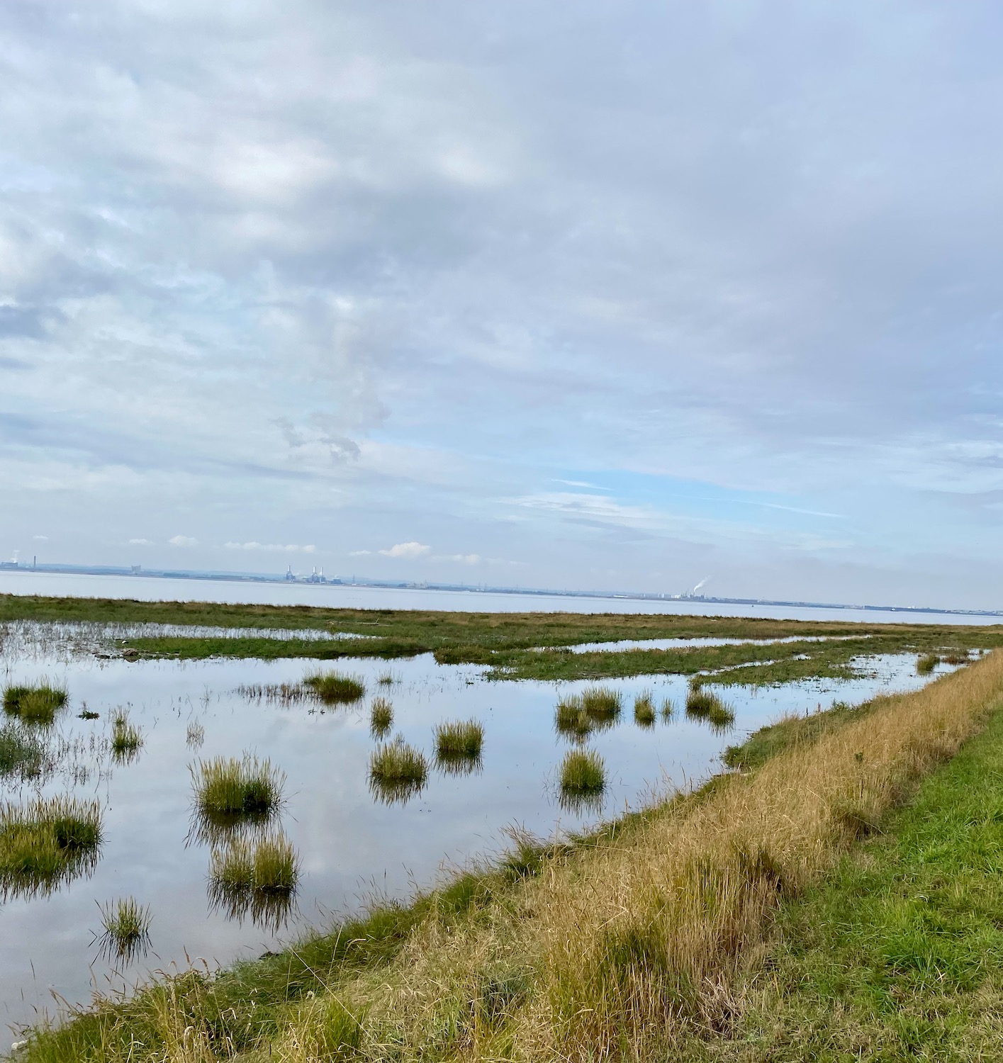
The path widens – marshes on the right, agriculture on the left.
Tufts of marsh grasses sit serenely in the still water……………
And then……what are these? Too large to be cow vertebrae………and how did they get here in the middle of the path? A mystery.
Further up the path stands what can only be called an obelisk, complete with its stainless steel plaques, marking the position of the Greenwich Meridian.
Longitude zero – good place to stop and have a rest.
A mile or so up the path, a couple of students from Hull University are measuring the carbon capture capacity of the marsh – or at least I think that’s what he said.
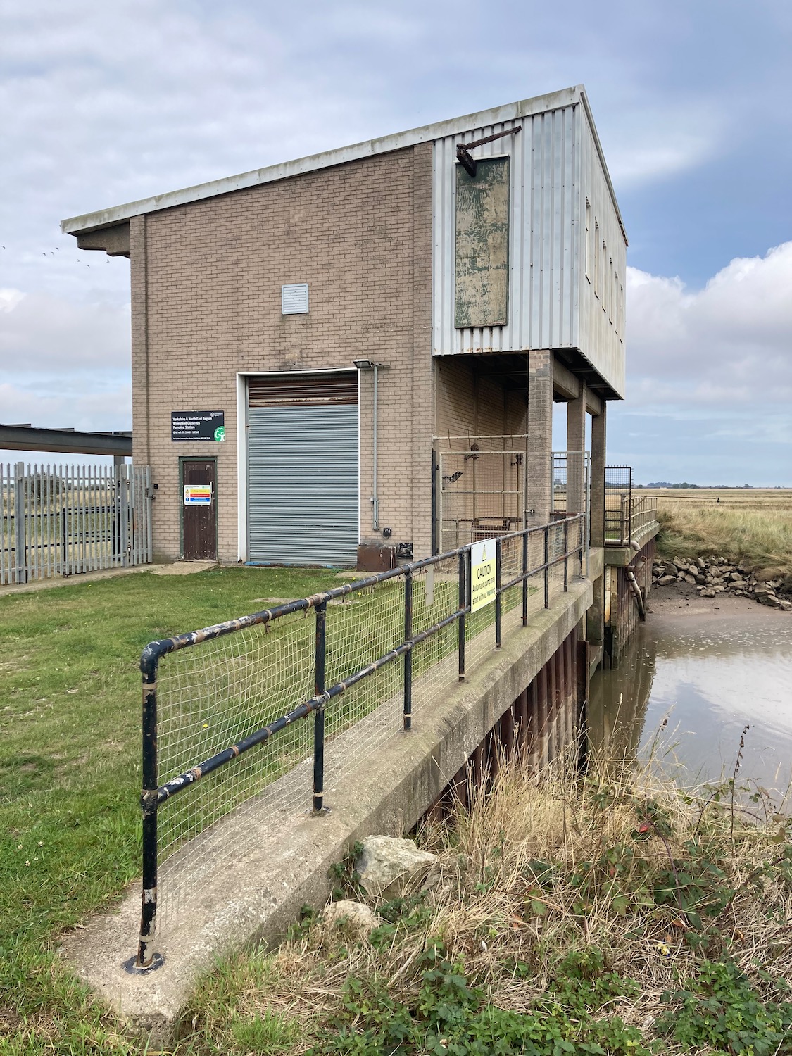
Soon we will have to turn inland as there is no easy way of getting across Patrington Channel.
The pumping station is armed to the teeth with spikes and tall gates and even if we were prepared for a mild impaling, the bog on the other side of it looks impassable. OK ok – we’ll turn round.
Back we go with the drain on our right, down a farm track heading up to a minor road which will take us to our destination. Off to the left a couple of diggers are performing circus tricks – it looks like they are laying the foundations of another embankment.
Another mile and we are approaching Patrington Haven – home to a substantial holiday park where we tried to find a pint and some food last night. Unfortunately the restaurant had burned down some months ago, so all hospitality moved into a marquee AND it was bingo night – didn’t really fancy it.
In the middle of the village stands a strange little building with its own war memorial. Built as a chapel for the Primitive Methodists in 1852, it has obviously been through a few facelifts in its time with rather unhappy results. Primitive Methodists were formed in 1811 as an offshoot of the main Wesleyan Methodist Church. They owe their Evangelical nature to the American movement of the same name, encouraging boisterous camp meetings and full equal status for men and women. The Primitive Methodists were the first to allow the ordination of women to full time ministry.
From here it is just a a short hop to Patrington where we are staying tonight.
The bus stop in Hornsea is right opposite the museum – I would have liked to have had a look inside but we need to get this last walk done before driving back to London tomorrow. We haven’t even made time to have a look at Hornsea Mere, which lies to the west of the town and is the largest freshwater lake in Yorkshire. Another time perhaps……
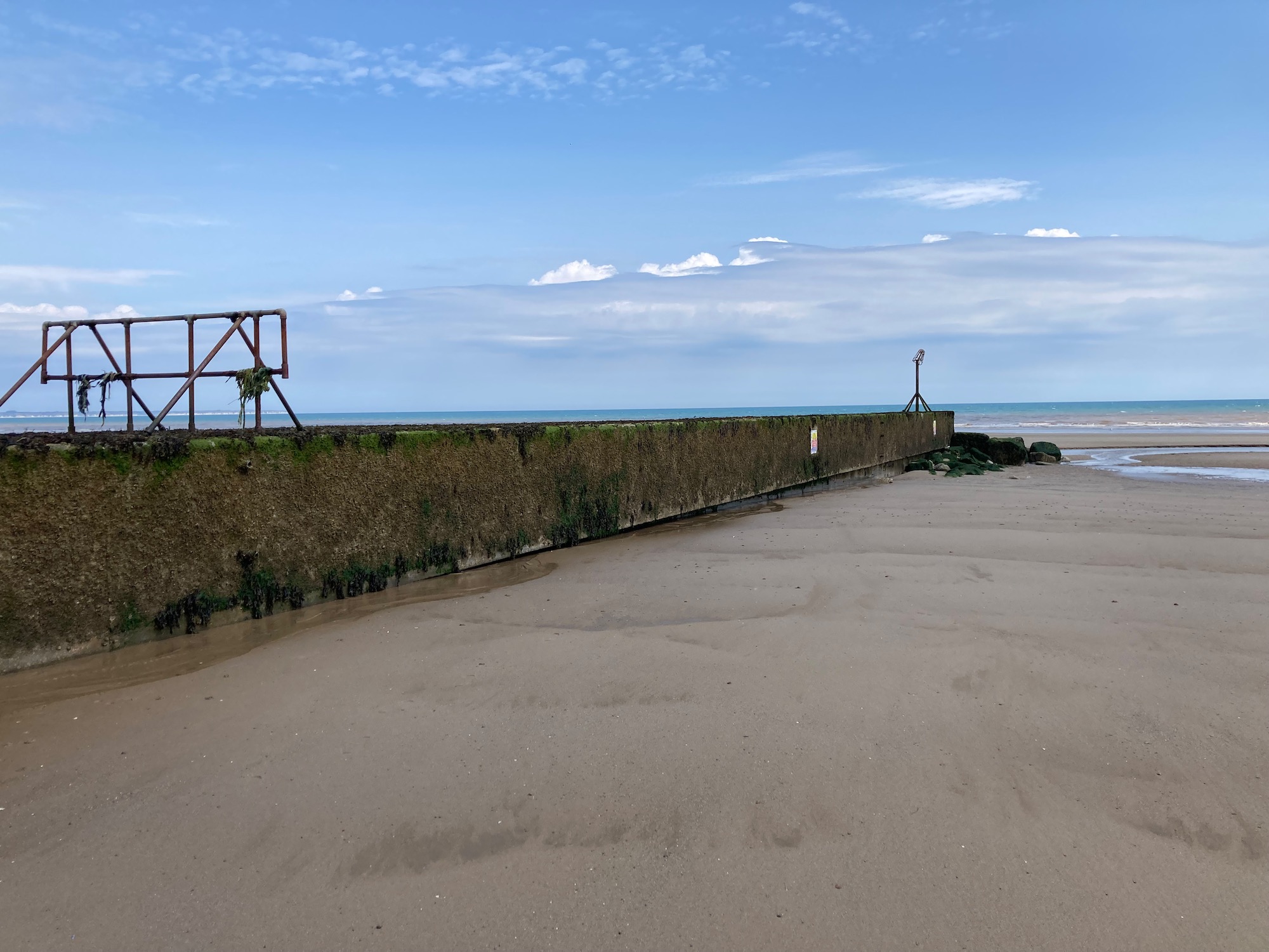
We are back at Fraisthorpe Sands turning right this time………Damian waits for me to tie my bootlaces.
Despite the overcast sky there are quite a few families braving the weather – maybe they know something I don’t…
The usual mouldering relics of second world war defences………..
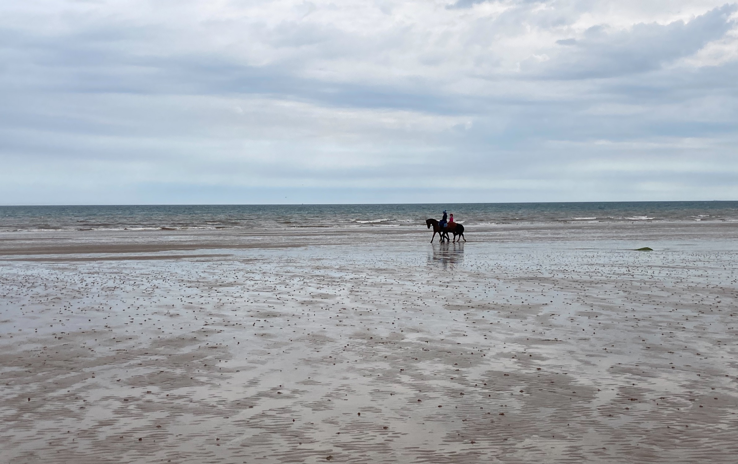
And in the distance a couple of pony riders. As I grew up in mid Wales there was not much chance of galloping along the beach – we had hills – but I have done it here in Denmark and there is nothing better.
The beach empties of people and we are alone……………………
After about two miles we are faced with the Barmston Main Drain which crosses the beach from the cliffs to the sea. As it is low tide we can easily get around the drain but it is at this point that I feel we should move up onto the cliffs as we are not sure of any access points ahead and I don’t want to get stranded.
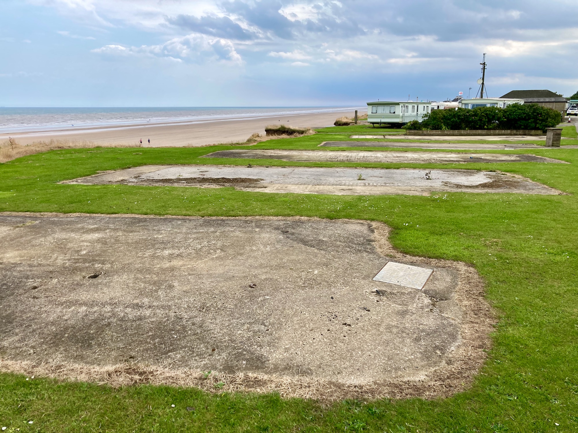
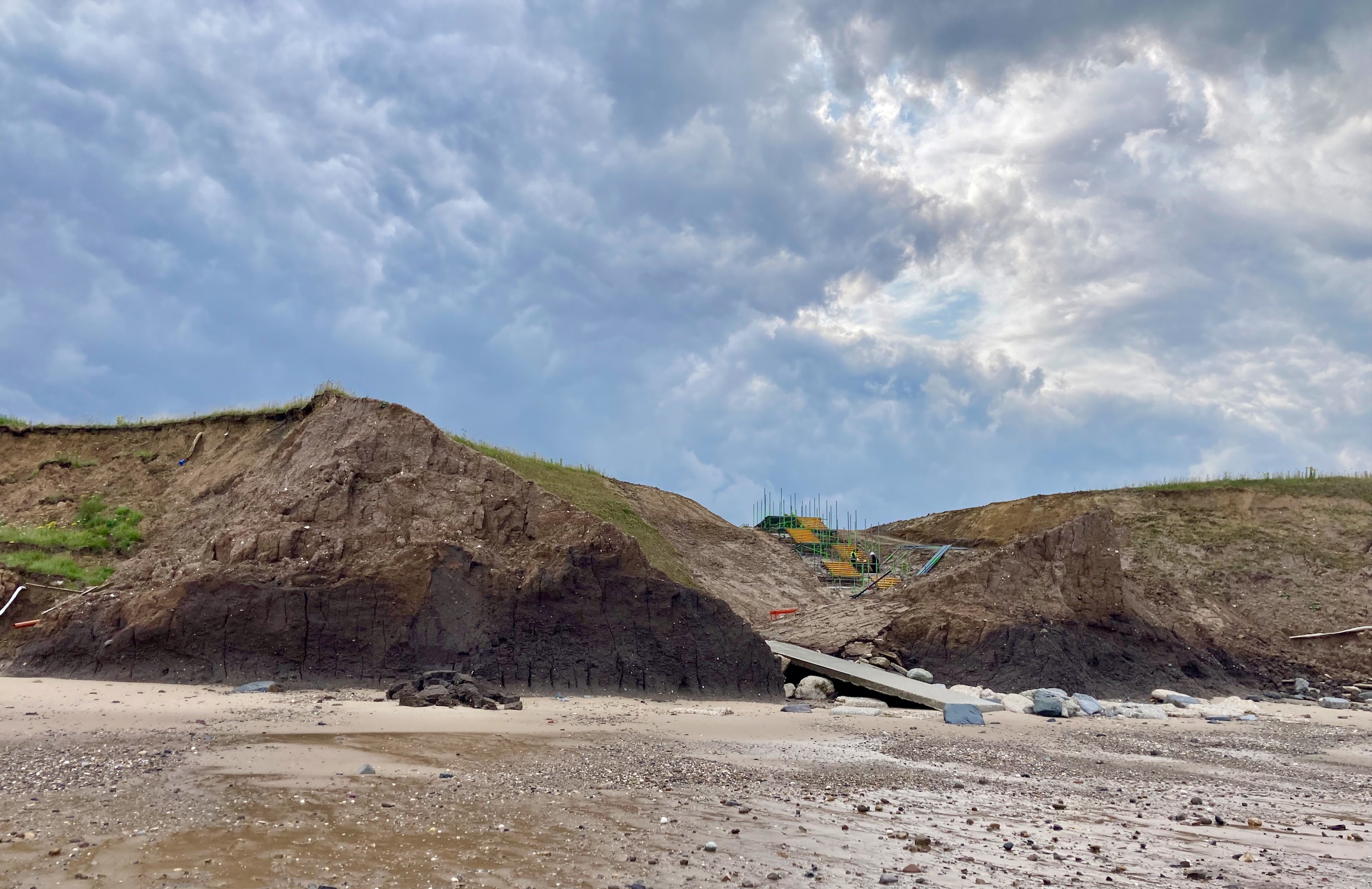
We clamber up from the beach to join a permissive path which runs along the cliff edge. This leads us to a small caravan park called the Criftins where the effects of coastal erosion are very clear. The concrete pads where caravans once stood are now empty, their drainage pipes hang limply from the sticky clay of the disintegrating cliffs.
A little later we pick our way carefully across the remains of a road…….
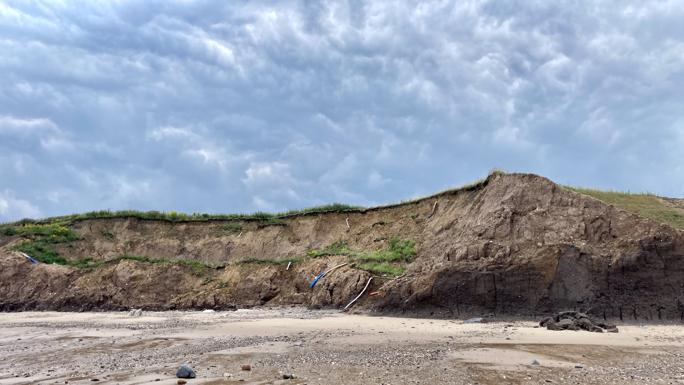
In the past few weeks we have been walking on the Holderness Coast, which is the fastest eroding coastline in Europe – it erodes at a rate of 4.5 meters a year. Roads, houses and caravans have been lost to the waves, as have safe footpaths down to the beach.
However, as walking along the beach will be so much quicker and more pleasant than following unreliable footpaths or roads, we now decide to go back to the beach down a boat launch road from the edge of the caravan site.
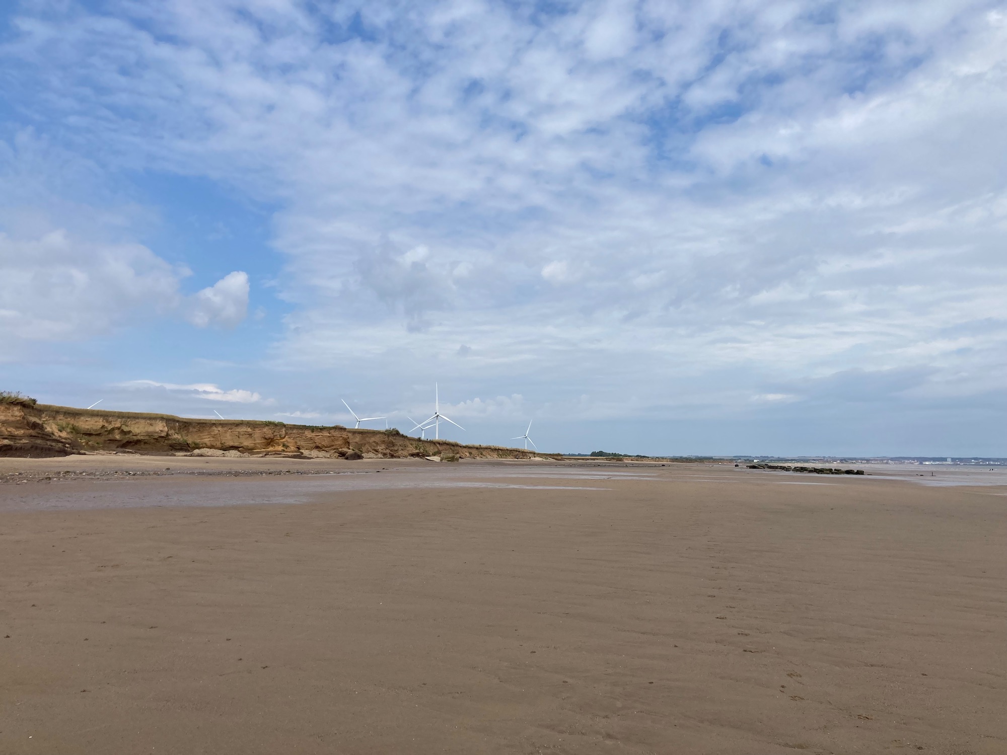
And from here on we are on the sand – we pass Cobble Gap and Skipsea, although we don’t see anything much apart from the roofs of caravans close to the cliff edge.
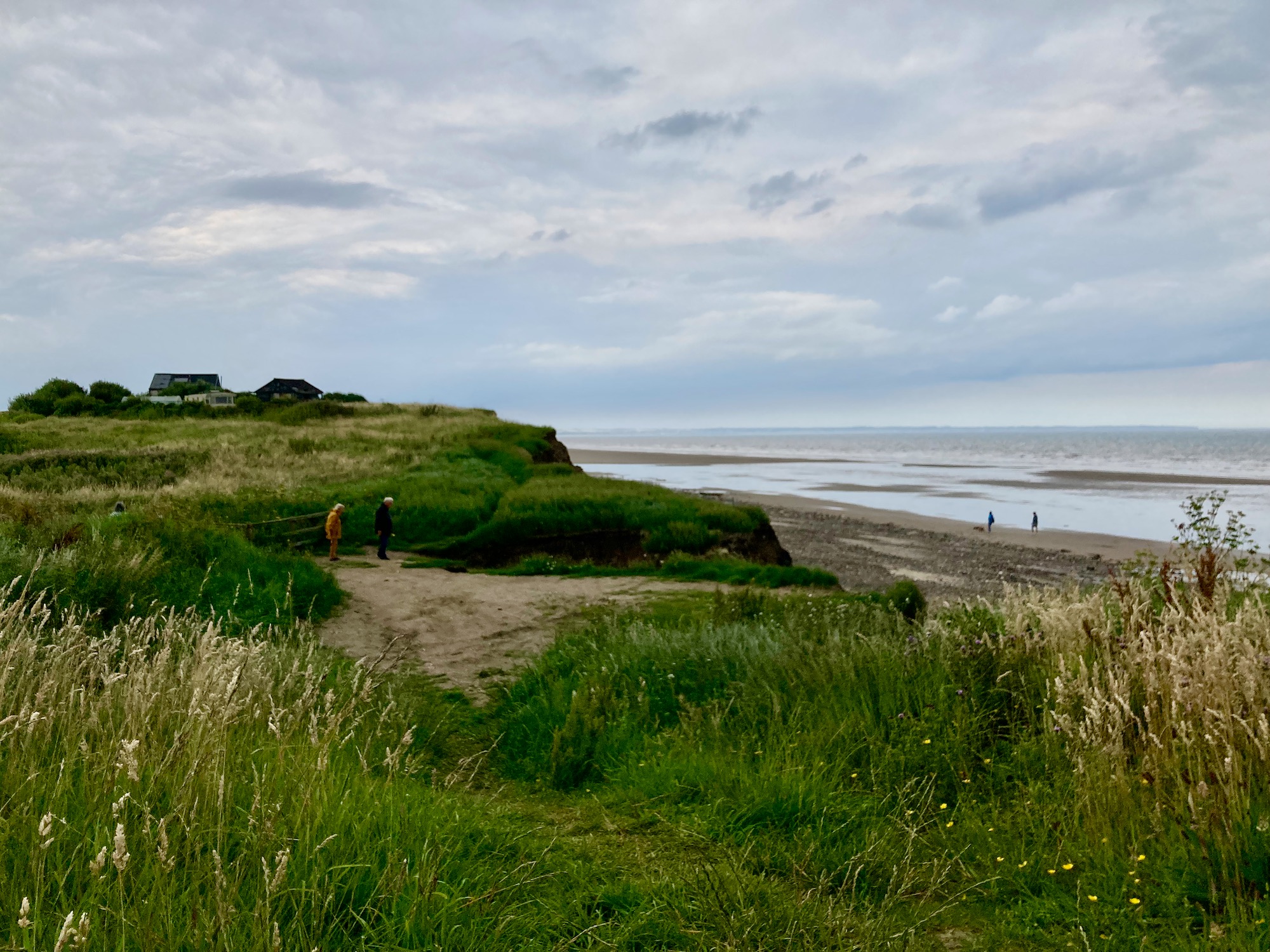
At one point we reach Withow Gap, where the cliffs are relatively low, so we scramble up and find a spot for lunch. It is a relief to be lying on warm grass and flowers after the slightly gloomy atmosphere of the debris on the beach and the crumbling cliffs.
After lunch it’s back to the beach and it’s only after a couple of miles that I start worrying again about getting off it. It should be possible to walk all the way to Hornsea before high tide but you never know………………
So…….as we walk past Skirlington caravan site I am relieved to see that there is a clear rocky path winding up from the beach to the top of the cliffs, so if we can’t climb up at Atwick, which is the next village, we can always come back.
On we go…………… drainage pipes dangling hopelessly from the cliffs to our right.
At one point it looks like some attempt is being made to create an access path, but I’m sure it will be no match for the next unexpected storm surge in the North Sea.
We meet a couple handing hands, skipping merrily towards us – they are not locals and have no idea whether there is safe passage at Atwick. We decide to turn round (or rather I do, Damian is a little braver than me).
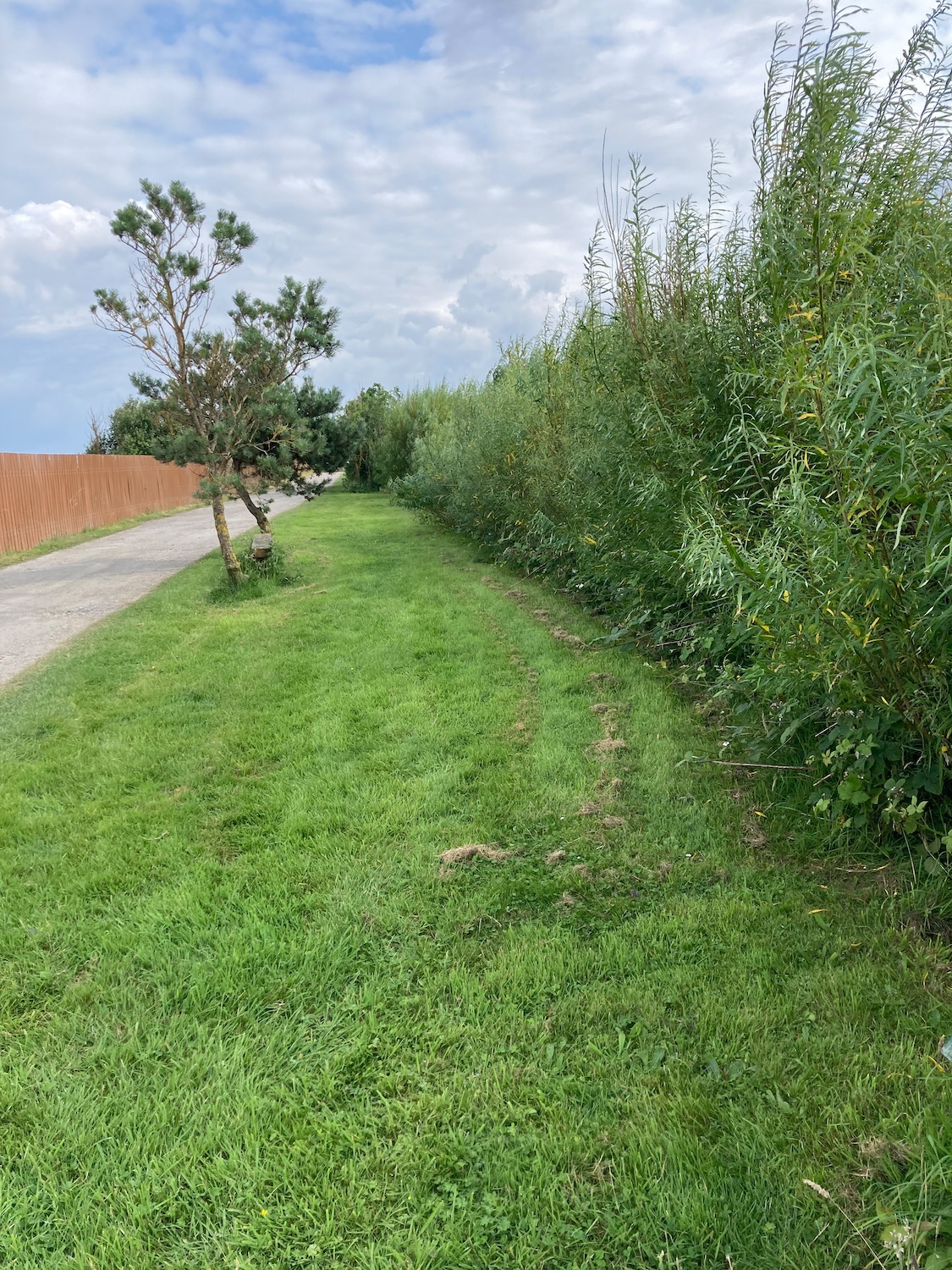
Back we go to the rocky cliff path at Skirlington, which takes us up to the caravan site where we wiggle our way through onto a marked footpath called Long Lane. And that is what it is – a long straight trail through fields. running parallel to the coast. We pass a wonky trig point – research tells me it has been moved back from the cliff edge to save it.
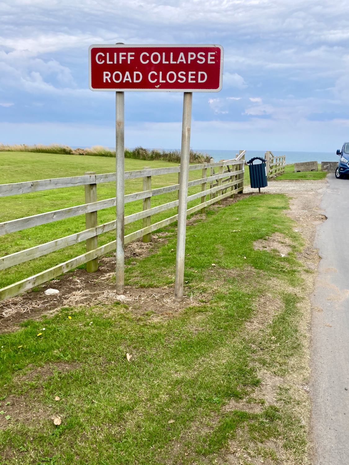
Long Lane comes to an end at a minor road – I look left and see the familiar warning sign.
We turn right and into yet another caravan site – two men are having a lively conversation so we wait until they’re finished and then ask for directions. The map does not show a clear path into Hornsea but local knowledge can be invaluable. To our delight the site owner says yes, there is a clear path all the way – we just need to walk through a couple of fields first. We start walking through the site…
It even has its own pill box….
When we come to the first field it is not clear what to do – there is a line of downtrodden grain through the field but it doesn’t look too promising. A couple of minutes later I hear a shout – Damian has found a clear path on the edge of the field so off we go.
A little later we come to what’s marked as an official footpath which circumvents a boatyard and carries on into the outskirts of Hornsea.
We are both very tired now and it’s difficult not to succumb to the invitation to rest, but we still have a mile or so to go until we reach the town centre.
Twenty minutes later we reach the Post Office – I take a picture of this quintessentially British phenomenon before we head off to the pub.